1310 products
-
 A Civil War Field Map of Fairfax County, Virginia With Fort Coccoran 1861A Civil War Field Map of Fairfax County, Virginia With Fort Coccoran 1861
- Regular price
-
$43.95 $88.95 - Regular price
-
$38.95 - Sale price
-
$43.95 $88.95
-
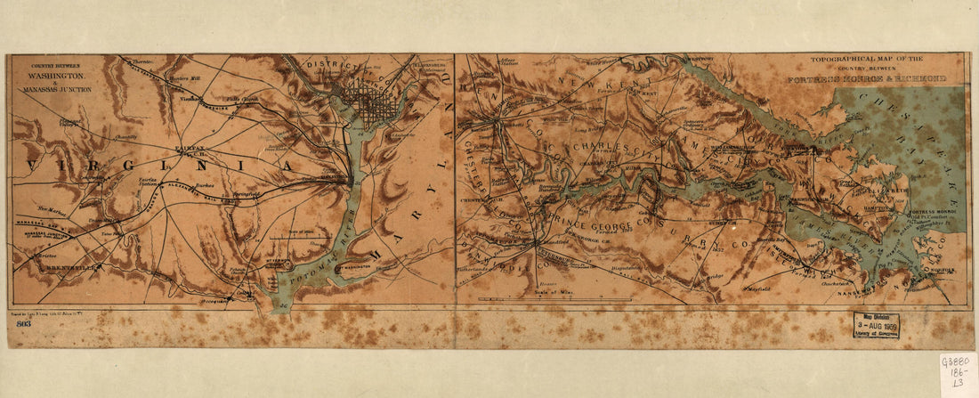 Country Between Washington & Manassas Junction and Topographical Map of the Country Between Fortress Monroe & Richmond 1865Country Between Washington & Manassas Junction and Topographical Map of the Country Between Fortress Monroe & Richmond 1865
- Regular price
-
$39.95 $99.95 - Regular price
-
$34.95 - Sale price
-
$39.95 $99.95
-
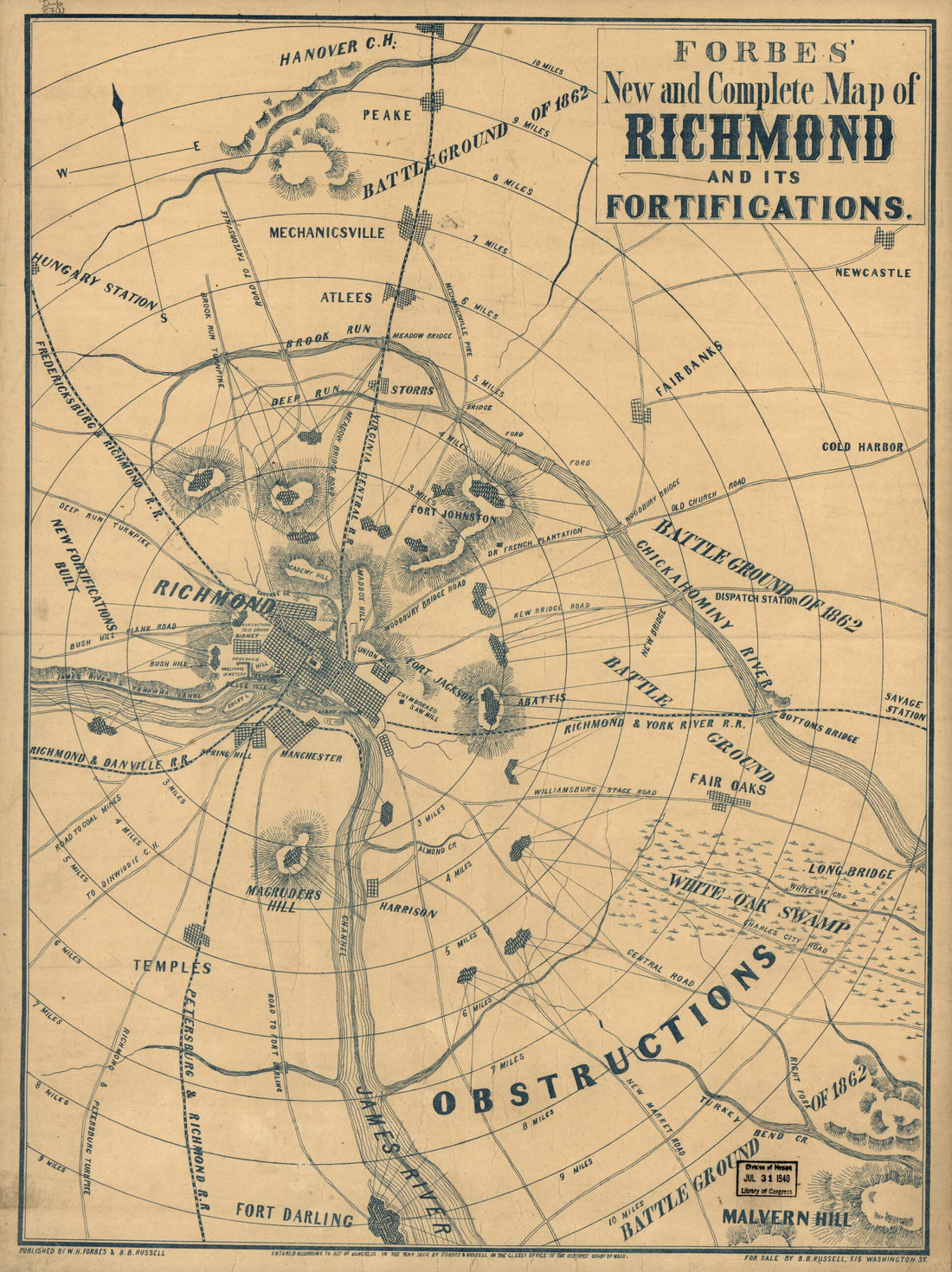 Forbes' New and Complete Map of Richmond and Its Fortifications 1864Forbes' New and Complete Map of Richmond and Its Fortifications 1864
- Regular price
-
$43.95 $88.95 - Regular price
-
$38.95 - Sale price
-
$43.95 $88.95
-
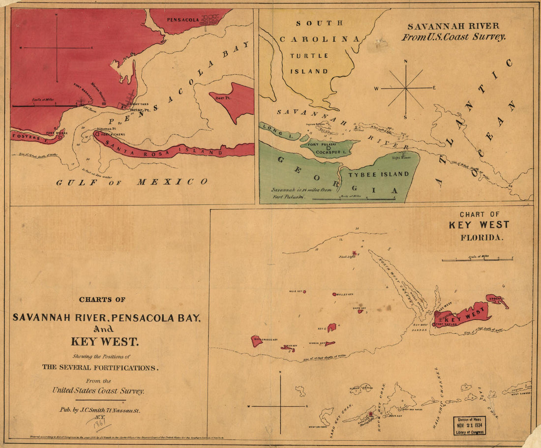 Charts of Savannah River, Pensacola Bay, and Key West. Showing the Positions of the Several Fortifications. from the United States Coast Survey 1861Charts of Savannah River, Pensacola Bay, and Key West. Showing the Positions of the Several Fortifications. from the United States Coast Survey 1861
- Regular price
-
$39.95 $83.95 - Regular price
-
$34.95 - Sale price
-
$39.95 $83.95
-
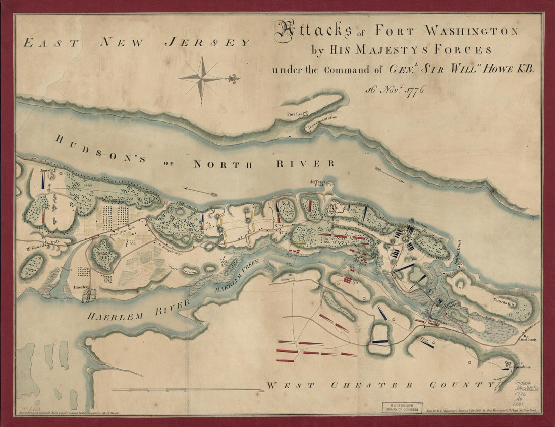 Attacks of Fort Washington by His Majesty's Forces Under the Command of Genl. Sir Willm Howe K.B. 16 Novr. 1776Attacks of Fort Washington by His Majesty's Forces Under the Command of Genl. Sir Willm Howe K.B. 16 Novr. 1776
- Regular price
-
$43.95 $88.95 - Regular price
-
$38.95 - Sale price
-
$43.95 $88.95
-
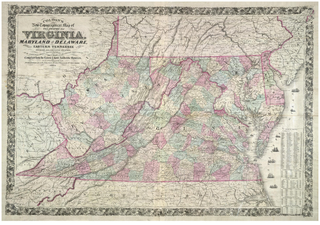 Colton's New Topographical Map of the States of Virginia, Maryland and Delaware, Showing Also Eastern Tennessee & Parts of Other Adjoining States, All the Fortifications, Military Stations, Rail Roads, Common Roads and Other Internal Improvements 1864Colton's New Topographical Map of the States of Virginia, Maryland and Delaware, Showing Also Eastern Tennessee & Parts of Other Adjoining States, All the Fortifications, Military Stations, Rail Roads, Common Roads and Other Internal Improvements 1864
- Regular price
-
$43.95 $155.95 - Regular price
-
$38.95 - Sale price
-
$43.95 $155.95
-
 Bassin) at the Head of the Bay of Fundi Upon the Istmus of Accadia Shewing That Harbour With Its Rivers, the Situation of the English Fort and Fort Possessed by the French, June 1755Bassin) at the Head of the Bay of Fundi Upon the Istmus of Accadia Shewing That Harbour With Its Rivers, the Situation of the English Fort and Fort Possessed by the French, June 1755
- Regular price
-
$39.95 $88.95 - Regular price
-
$34.95 - Sale price
-
$39.95 $88.95
-
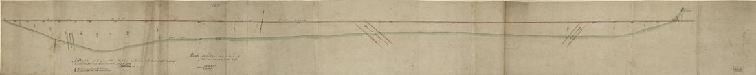 A Profile of the Ground Between Fort Green On the Jacksons Hill Southeast of the Wall About to Cobble Hill Fort Near Gowannes Creek Aug. 10th in 1814A Profile of the Ground Between Fort Green On the Jacksons Hill Southeast of the Wall About to Cobble Hill Fort Near Gowannes Creek Aug. 10th in 1814
- Regular price
-
$46.95 $99.95 - Regular price
-
$41.95 - Sale price
-
$46.95 $99.95
-
 A New & Accurate Map of Bermudas Or Sommer's Islands, Taken from an Actual Survey; Wherein the Errors of Former Charts Are Corrected. an Accurate Map of the Island of St. Christopher, Vulgarly Called S. Kits, Containing All the Towns, Parishes, Forts ...A New & Accurate Map of Bermudas Or Sommer's Islands, Taken from an Actual Survey; Wherein the Errors of Former Charts Are Corrected. an Accurate Map of the Island of St. Christopher, Vulgarly Called S. Kits, Containing All the Towns, Parishes, Forts ...
- Regular price
-
$43.95 $83.95 - Regular price
-
$30.95 - Sale price
-
$43.95 $83.95
-
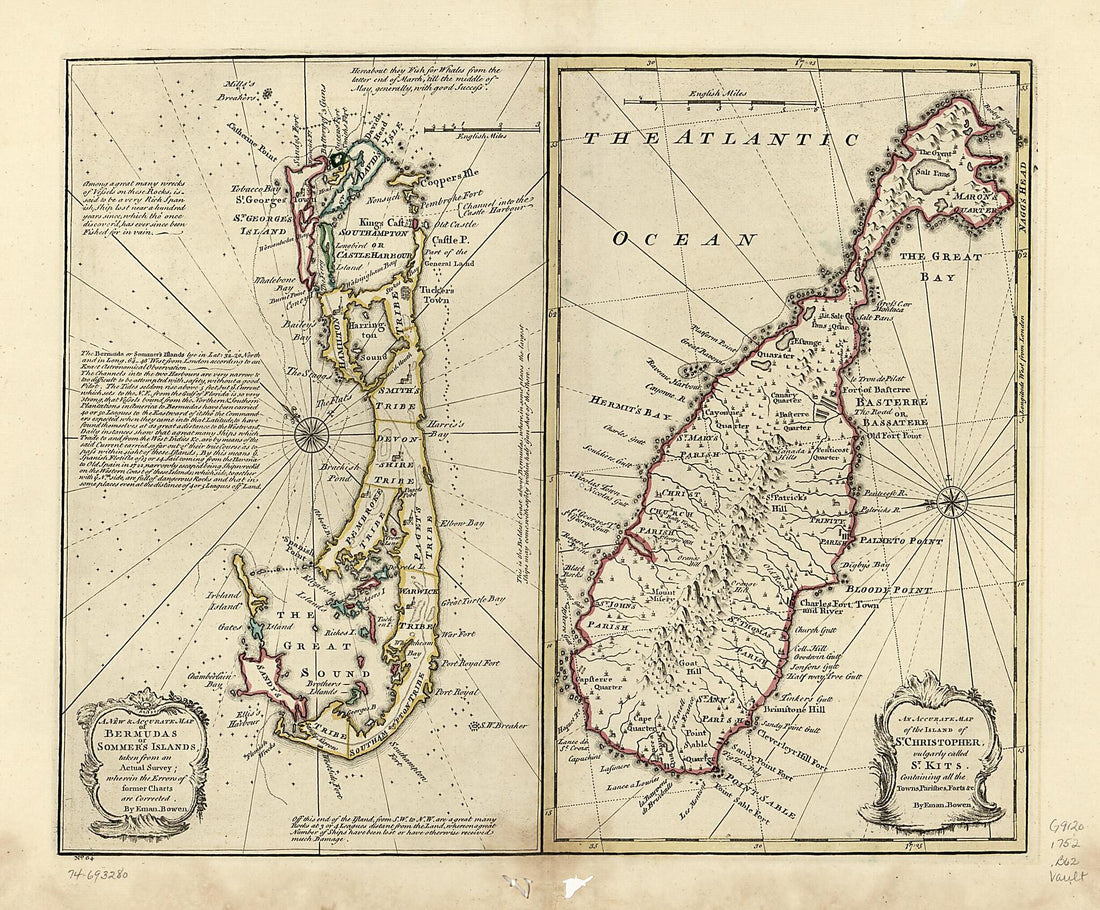 A New & Accurate Map of Bermudas Or Sommer's Islands, Taken from an Actual Survey; Wherein the Errors of Former Charts Are Corrected. an Accurate Map of the Island of St. Christopher, Vulgarly Called St. Kits, Containing All the Towns, Parishes, Forts...A New & Accurate Map of Bermudas Or Sommer's Islands, Taken from an Actual Survey; Wherein the Errors of Former Charts Are Corrected. an Accurate Map of the Island of St. Christopher, Vulgarly Called St. Kits, Containing All the Towns, Parishes, Forts...
- Regular price
-
$43.95 $83.95 - Regular price
-
$38.95 - Sale price
-
$43.95 $83.95
-
 A Topographical Map of the Northn. Part of New York Island, Exhibiting the Plan of Fort Washington, Now Fort Knyphausen, With the Rebels Lines to the Southward, Which Were Forced by the Troops Under the Command of the Rt. Honble. Earl Percy, On the 16...A Topographical Map of the Northn. Part of New York Island, Exhibiting the Plan of Fort Washington, Now Fort Knyphausen, With the Rebels Lines to the Southward, Which Were Forced by the Troops Under the Command of the Rt. Honble. Earl Percy, On the 16...
- Regular price
-
$39.95 $99.95 - Regular price
-
$34.95 - Sale price
-
$39.95 $99.95
-
 Beaufort District, South Carolina 1825Beaufort District, South Carolina 1825
- Regular price
-
$43.95 $91.95 - Regular price
-
$38.95 - Sale price
-
$43.95 $91.95


