1310 products
-
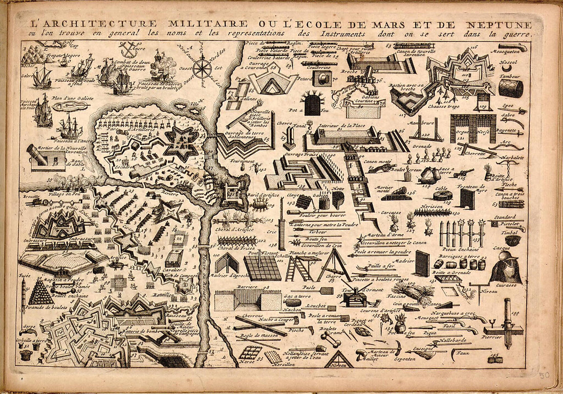 Atlas Portatif, Ou, Le Nouveau Theatre De La Guerre En Europe : Contenant Les Cartes Geographiques, Avec Les Plans Des Villes & Forteresses Les Plus Exposées Aux Revolutions Presentes : Accompagné D'une Nouvellle Methode Pour Apprendre Facilement La...Atlas Portatif, Ou, Le Nouveau Theatre De La Guerre En Europe : Contenant Les Cartes Geographiques, Avec Les Plans Des Villes & Forteresses Les Plus Exposées Aux Revolutions Presentes : Accompagné D'une Nouvellle Methode Pour Apprendre Facilement La...
- Regular price
-
$39.95 $99.95 - Regular price
-
$34.95 - Sale price
-
$39.95 $99.95
-
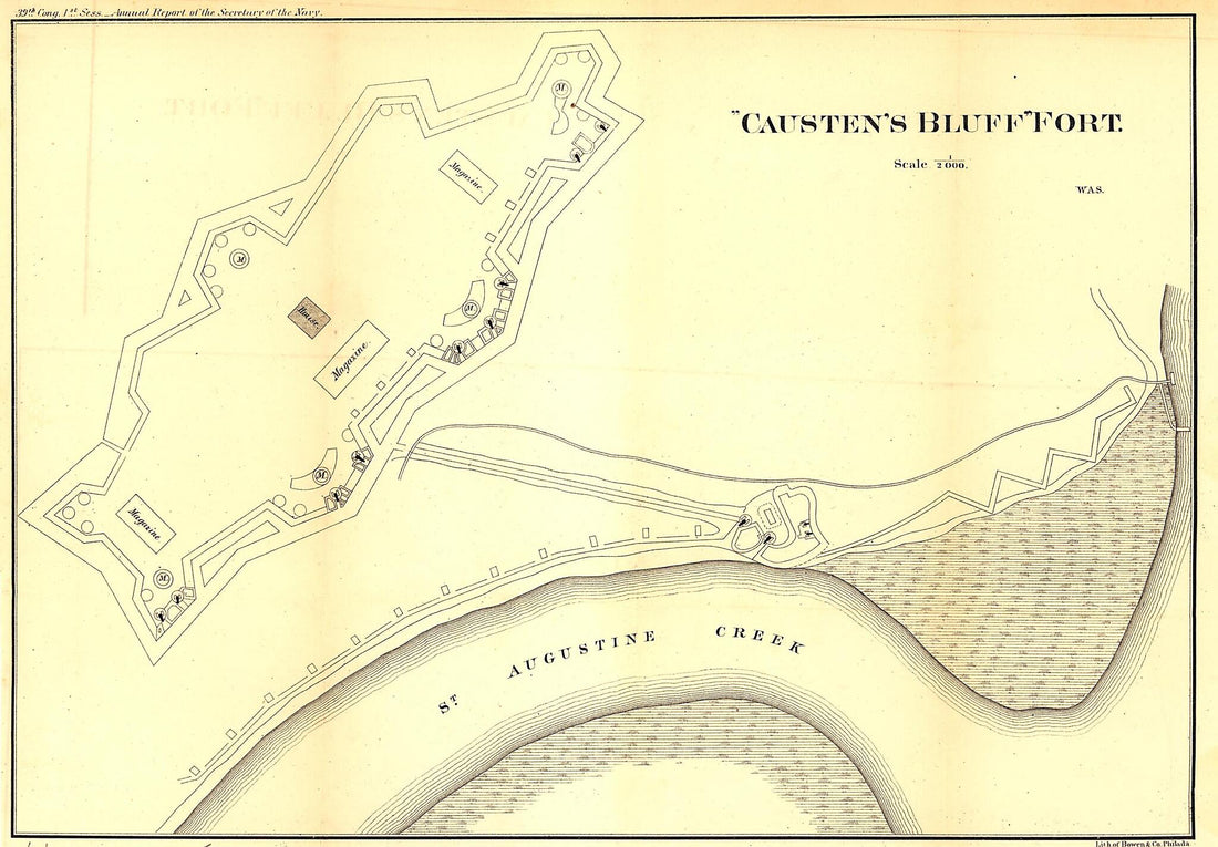 Causten's Bluff Fort. Defenses of Savannah, Georgia. in 1865Causten's Bluff Fort. Defenses of Savannah, Georgia. in 1865
- Regular price
-
$39.95 $99.95 - Regular price
-
$30.95 - Sale price
-
$39.95 $99.95
-
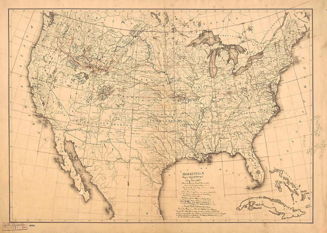 Bonneville May 1 1832 (Fort Osage) to Aug. 22 1835 1868Bonneville May 1 1832 (Fort Osage) to Aug. 22 1835 1868
- Regular price
-
$43.95 $147.95 - Regular price
-
$38.95 - Sale price
-
$43.95 $147.95
-
 A New and Accurate Map of the English Empire In North America: Representing Their Rightful Claim As Confirm'd by Charters, and the Formal Surrender of Their Indian Friends; Likewise the Encroachments of the French, With the Several Forts They Have Unj...A New and Accurate Map of the English Empire In North America: Representing Their Rightful Claim As Confirm'd by Charters, and the Formal Surrender of Their Indian Friends; Likewise the Encroachments of the French, With the Several Forts They Have Unj...
- Regular price
-
$43.95 $83.95 - Regular price
-
$38.95 - Sale price
-
$43.95 $83.95
-
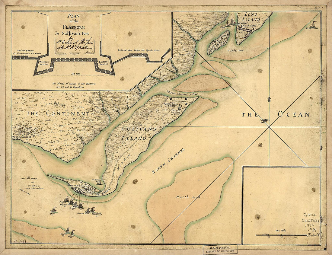 A Plan of the Attack of Fort Sulivan, Near Charles Town In South Carolina by a Squadron of His Majesty's Ships On the 28th Day of June 1776, With the Disposition of the King's Land Forces and the Encampments and Entrenchments of the Rebels, from the D...A Plan of the Attack of Fort Sulivan, Near Charles Town In South Carolina by a Squadron of His Majesty's Ships On the 28th Day of June 1776, With the Disposition of the King's Land Forces and the Encampments and Entrenchments of the Rebels, from the D...
- Regular price
-
$39.95 $88.95 - Regular price
-
$34.95 - Sale price
-
$39.95 $88.95
-
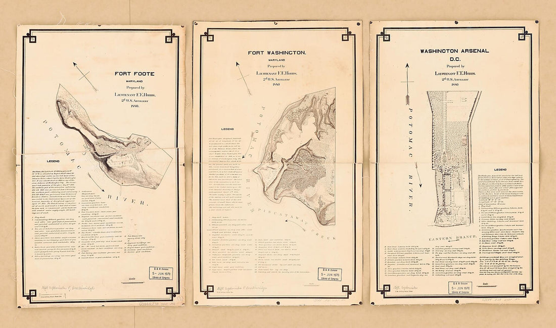 Artillery School Copies of Lieut. Hobbs' Maps of Forts Foote & Washington, and Washington Arsenal : While These Were Under the Military Supervision of Brevet Major J. C. Breckinridge, Captain, 2d Artillery, 1880Artillery School Copies of Lieut. Hobbs' Maps of Forts Foote & Washington, and Washington Arsenal : While These Were Under the Military Supervision of Brevet Major J. C. Breckinridge, Captain, 2d Artillery, 1880
- Regular price
-
$46.95 $133.95 - Regular price
-
$41.95 - Sale price
-
$46.95 $133.95
-
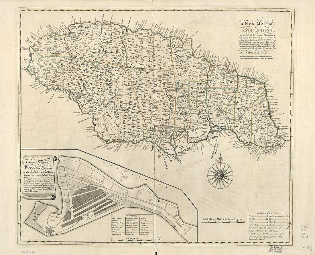 A New Map of Jamaica; In Which the Several Towns, Forts, & Settlements Are Accurately Laid Down, As Well As the Situations & Depths of the Most Noted Harbours and Anchoring Places 1770A New Map of Jamaica; In Which the Several Towns, Forts, & Settlements Are Accurately Laid Down, As Well As the Situations & Depths of the Most Noted Harbours and Anchoring Places 1770
- Regular price
-
$43.95 $210.95 - Regular price
-
$38.95 - Sale price
-
$43.95 $210.95
-
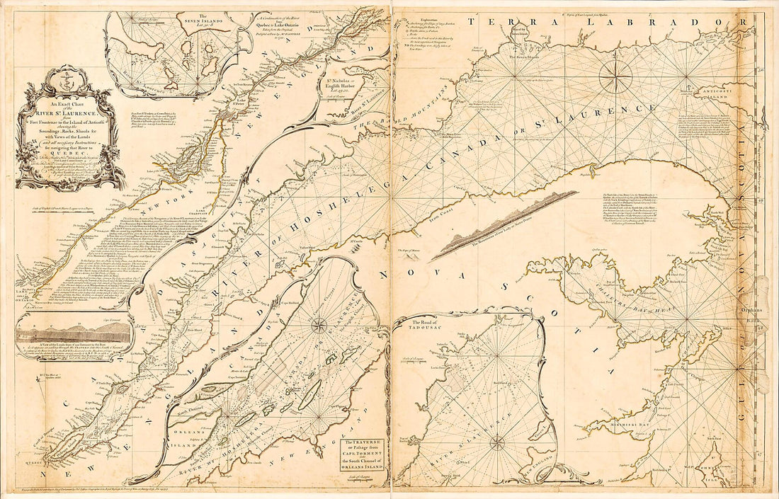 An Exact Chart of the River St. Laurence, from Fort Frontenac to the Island of Anticosti Shewing the Soundings, Rocks, Shoals &c With Views of the Lands and All Necessary Instructions for Navigating That River to Quebec 1757An Exact Chart of the River St. Laurence, from Fort Frontenac to the Island of Anticosti Shewing the Soundings, Rocks, Shoals &c With Views of the Lands and All Necessary Instructions for Navigating That River to Quebec 1757
- Regular price
-
$46.95 $218.95 - Regular price
-
$41.95 - Sale price
-
$46.95 $218.95
-
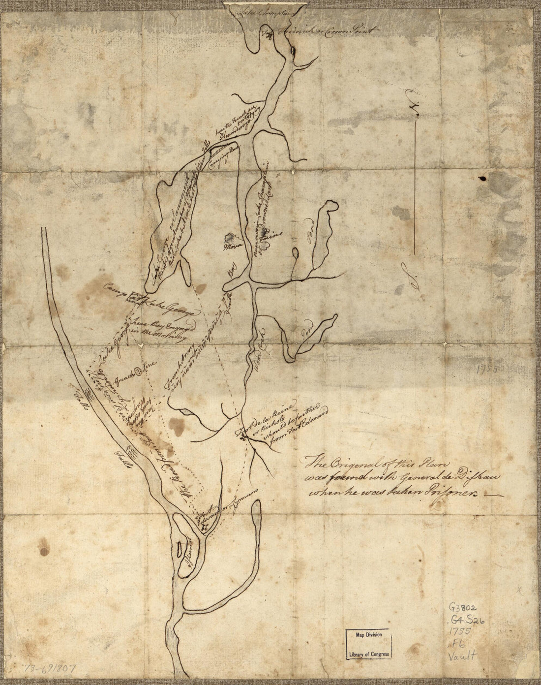 Fort Edward to Crown Point in 1755Fort Edward to Crown Point in 1755
- Regular price
-
$39.95 $83.95 - Regular price
-
$34.95 - Sale price
-
$39.95 $83.95
-
 A Section of Colton's Large Map of Indiana With the Fort Wayne and Southern Rail Road Marked Upon It, As Located Also a Map of the United States Showing Road and Its Connections Together With a Profile of the Ohio River and Lands Adjoining and a Secti...A Section of Colton's Large Map of Indiana With the Fort Wayne and Southern Rail Road Marked Upon It, As Located Also a Map of the United States Showing Road and Its Connections Together With a Profile of the Ohio River and Lands Adjoining and a Secti...
- Regular price
-
$43.95 $138.95 - Regular price
-
$38.95 - Sale price
-
$43.95 $138.95
-
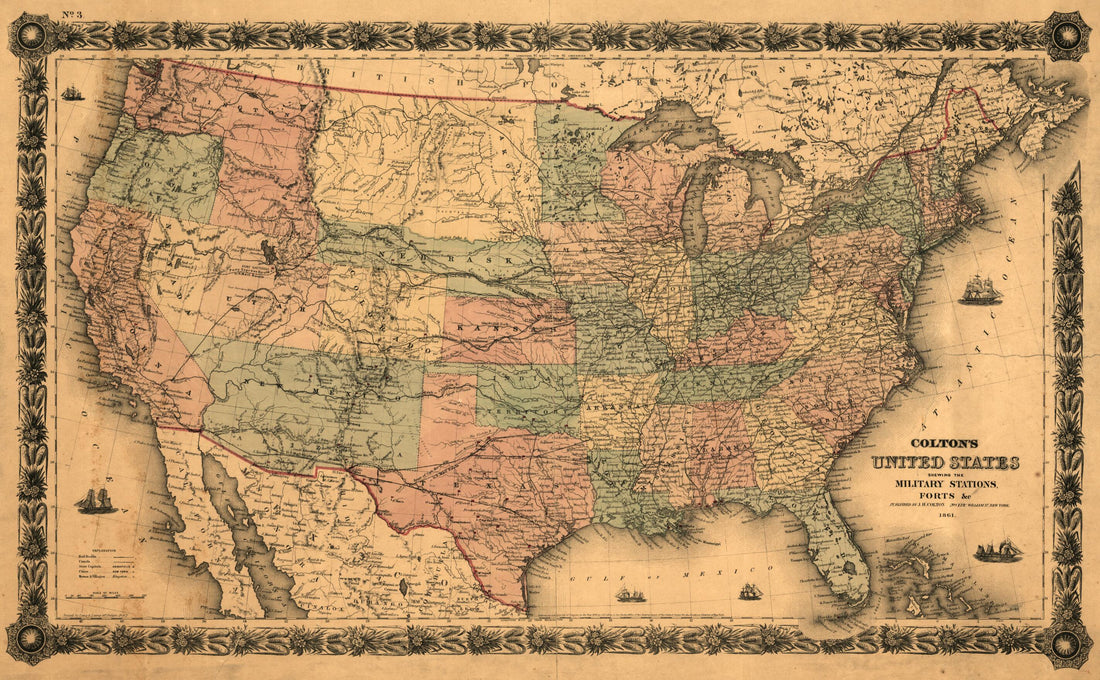 Colton's United States Shewing the Military Stations, Forts &c. Entered According to Act of Congress In the Year 1855, by J.H. Colton in 1861Colton's United States Shewing the Military Stations, Forts &c. Entered According to Act of Congress In the Year 1855, by J.H. Colton in 1861
- Regular price
-
$46.95 $99.95 - Regular price
-
$41.95 - Sale price
-
$46.95 $99.95
-
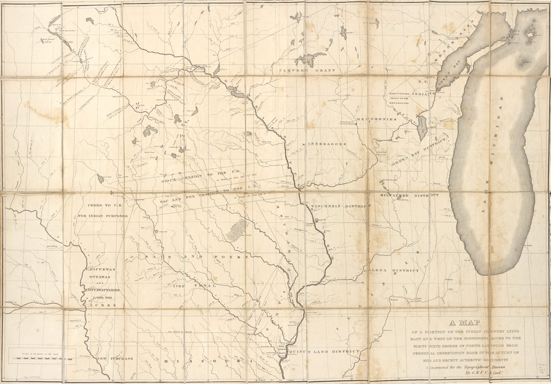 A Map of a Portion of the Indian Country Lying East and West of the Mississippi River to the Forty Sixth Degree of North Latitude From Personal Observation Made In the Autumn of 1835 and Recent Authentic Documents in 1836A Map of a Portion of the Indian Country Lying East and West of the Mississippi River to the Forty Sixth Degree of North Latitude From Personal Observation Made In the Autumn of 1835 and Recent Authentic Documents in 1836
- Regular price
-
$46.95 $187.95 - Regular price
-
$41.95 - Sale price
-
$46.95 $187.95


