1310 products
-
 Colton's New Topographical Map of the States of Virginia, Maryland & Delaware : Showing Also Eastern Tennessee & Parts of All the Fortifications, Military Stations, Railroads, Common Roads, and Other Internal Improvements (Colton's Map of Virginia) 1862Colton's New Topographical Map of the States of Virginia, Maryland & Delaware : Showing Also Eastern Tennessee & Parts of All the Fortifications, Military Stations, Railroads, Common Roads, and Other Internal Improvements (Colton's Map of Virginia) 1862
- Regular price
-
$46.95 $161.95 - Regular price
-
$41.95 - Sale price
-
$46.95 $161.95
-
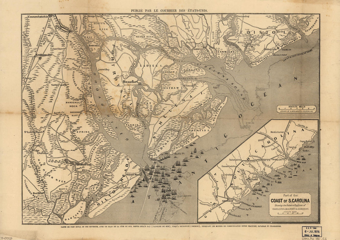 Carte De Port Royal Et Des Environs : Avec Un Plan De La Côte Du Sud, Depuis Bull's Bay (Caroline Du Sud), Jusqu'à Brunswick (Géorgie), Indiquant Les Moyens De Communication Entre Beaufort, Savanah sic Ft. Charleston in 1860Carte De Port Royal Et Des Environs : Avec Un Plan De La Côte Du Sud, Depuis Bull's Bay (Caroline Du Sud), Jusqu'à Brunswick (Géorgie), Indiquant Les Moyens De Communication Entre Beaufort, Savanah sic Ft. Charleston in 1860
- Regular price
-
$43.95 $88.95 - Regular price
-
$38.95 - Sale price
-
$43.95 $88.95
-
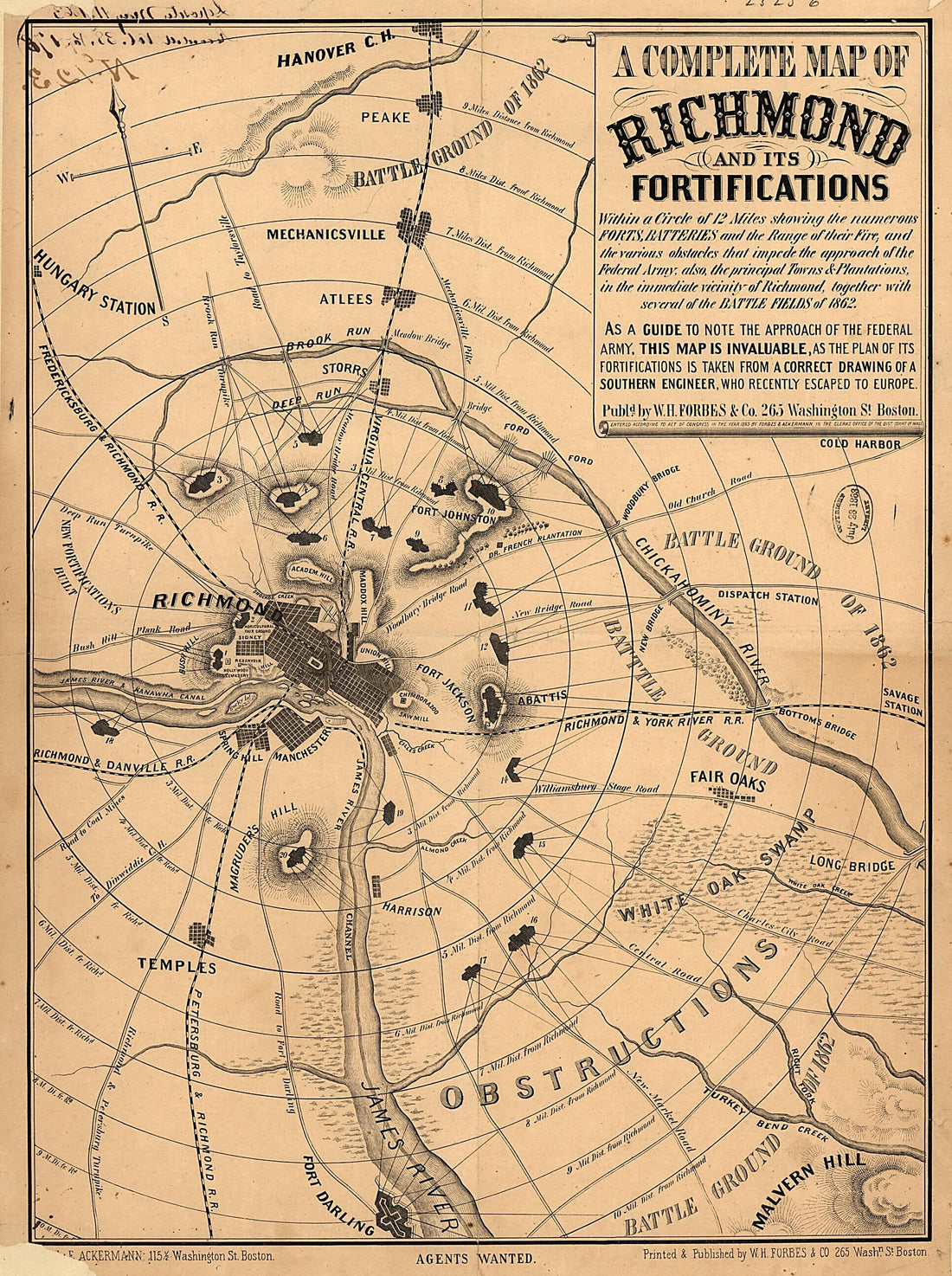 A Complete Map of Richmond and Its Fortifications Within a Circle of 12 Miles Showing the Numerous Forts, Batteries and the Range of Their Fire, and the Various Obstacles That Impede the Approach of the Federal Army, Also, the Principal Towns & Planta...A Complete Map of Richmond and Its Fortifications Within a Circle of 12 Miles Showing the Numerous Forts, Batteries and the Range of Their Fire, and the Various Obstacles That Impede the Approach of the Federal Army, Also, the Principal Towns & Planta...
- Regular price
-
$43.95 $106.95 - Regular price
-
$38.95 - Sale price
-
$43.95 $106.95
-
 Bacon's Military Map of the United States Shewing the Forts & Fortifications 1862Bacon's Military Map of the United States Shewing the Forts & Fortifications 1862
- Regular price
-
$46.95 $99.95 - Regular price
-
$41.95 - Sale price
-
$46.95 $99.95
-
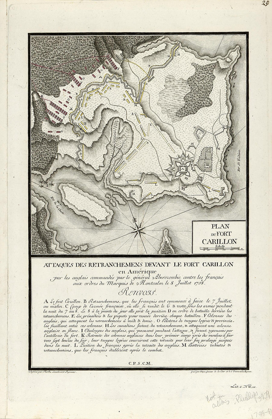 Attaques Des Retranchemens sic Devant Le Fort Carillon En Amérique : Par Les Anglais Commandés Par Le Général Abercrombie Contre Les Français Aux Ordres Du Marquis De Montcalm Le 8 Juillet 1758Attaques Des Retranchemens sic Devant Le Fort Carillon En Amérique : Par Les Anglais Commandés Par Le Général Abercrombie Contre Les Français Aux Ordres Du Marquis De Montcalm Le 8 Juillet 1758
- Regular price
-
$39.95 $99.95 - Regular price
-
$34.95 - Sale price
-
$39.95 $99.95
-
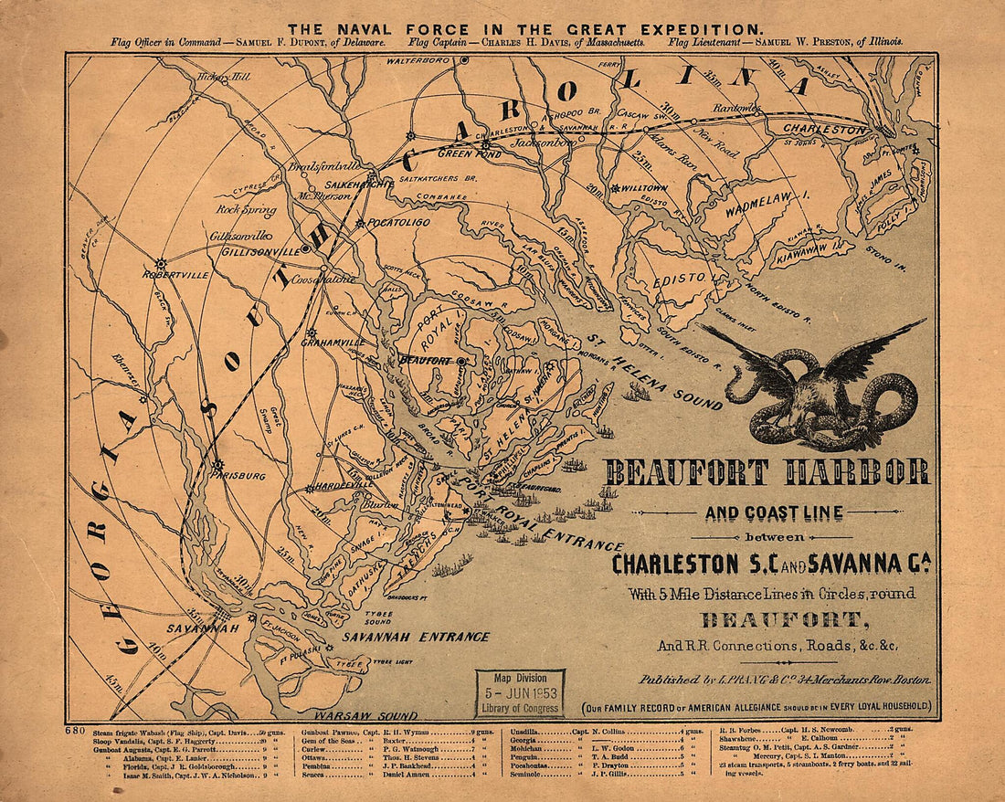 Beaufort Harbor and Coast Line Between Charleston, S.C. and Savanna sic Ga., With 5 Mile Distance Lines In Circles Round Beaufort, and Railroad Connections, Roads, &c, &c 1861Beaufort Harbor and Coast Line Between Charleston, S.C. and Savanna sic Ga., With 5 Mile Distance Lines In Circles Round Beaufort, and Railroad Connections, Roads, &c, &c 1861
- Regular price
-
$39.95 $83.95 - Regular price
-
$34.95 - Sale price
-
$39.95 $83.95
-
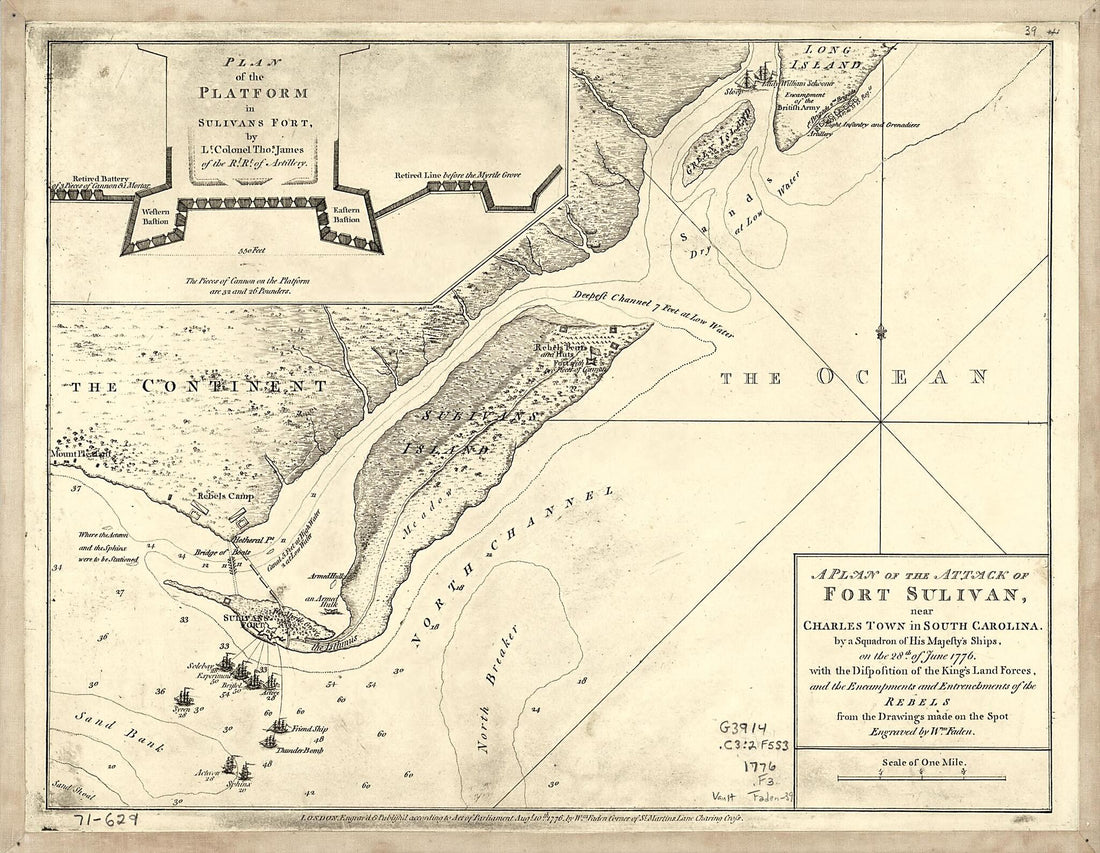 A Plan of the Attack of Fort Sulivan, Near Charles Town In South Carolina : by a Squadron of His Majesty's Ships, On the 28th of June 1776, With the Disposition of the King's Land Forces, and the Encampments and Entrenchments of the Rebels from the Dr...A Plan of the Attack of Fort Sulivan, Near Charles Town In South Carolina : by a Squadron of His Majesty's Ships, On the 28th of June 1776, With the Disposition of the King's Land Forces, and the Encampments and Entrenchments of the Rebels from the Dr...
- Regular price
-
$39.95 $83.95 - Regular price
-
$34.95 - Sale price
-
$39.95 $83.95
-
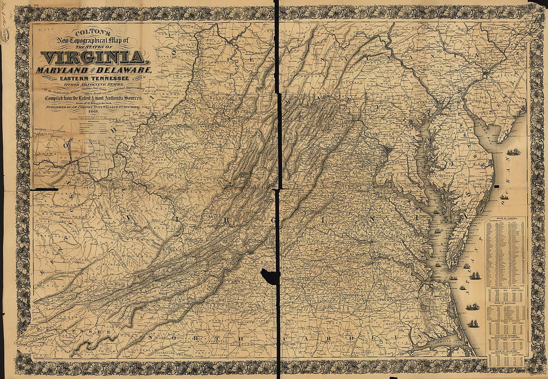 Colton's New Topographical Map of the States of Virginia, Maryland and Delaware, Showing Also Eastern Tennessee & Parts of Other Adjoining States, All the Fortifications, Military Stations, Rail Roads, Common Roads and Other Internal Improvements 1862Colton's New Topographical Map of the States of Virginia, Maryland and Delaware, Showing Also Eastern Tennessee & Parts of Other Adjoining States, All the Fortifications, Military Stations, Rail Roads, Common Roads and Other Internal Improvements 1862
- Regular price
-
$46.95 $152.95 - Regular price
-
$41.95 - Sale price
-
$46.95 $152.95
-
 An Anciente Mappe of Fairyland : Newly Discovered and Set Forth : imaginary Locality in 1920An Anciente Mappe of Fairyland : Newly Discovered and Set Forth : imaginary Locality in 1920
- Regular price
-
$46.95 $242.95 - Regular price
-
$41.95 - Sale price
-
$46.95 $242.95
-
 A Map of Mackenzie's Track from Fort Chipewyan to the North Sea In 1789 1801A Map of Mackenzie's Track from Fort Chipewyan to the North Sea In 1789 1801
- Regular price
-
$43.95 $83.95 - Regular price
-
$38.95 - Sale price
-
$43.95 $83.95
-
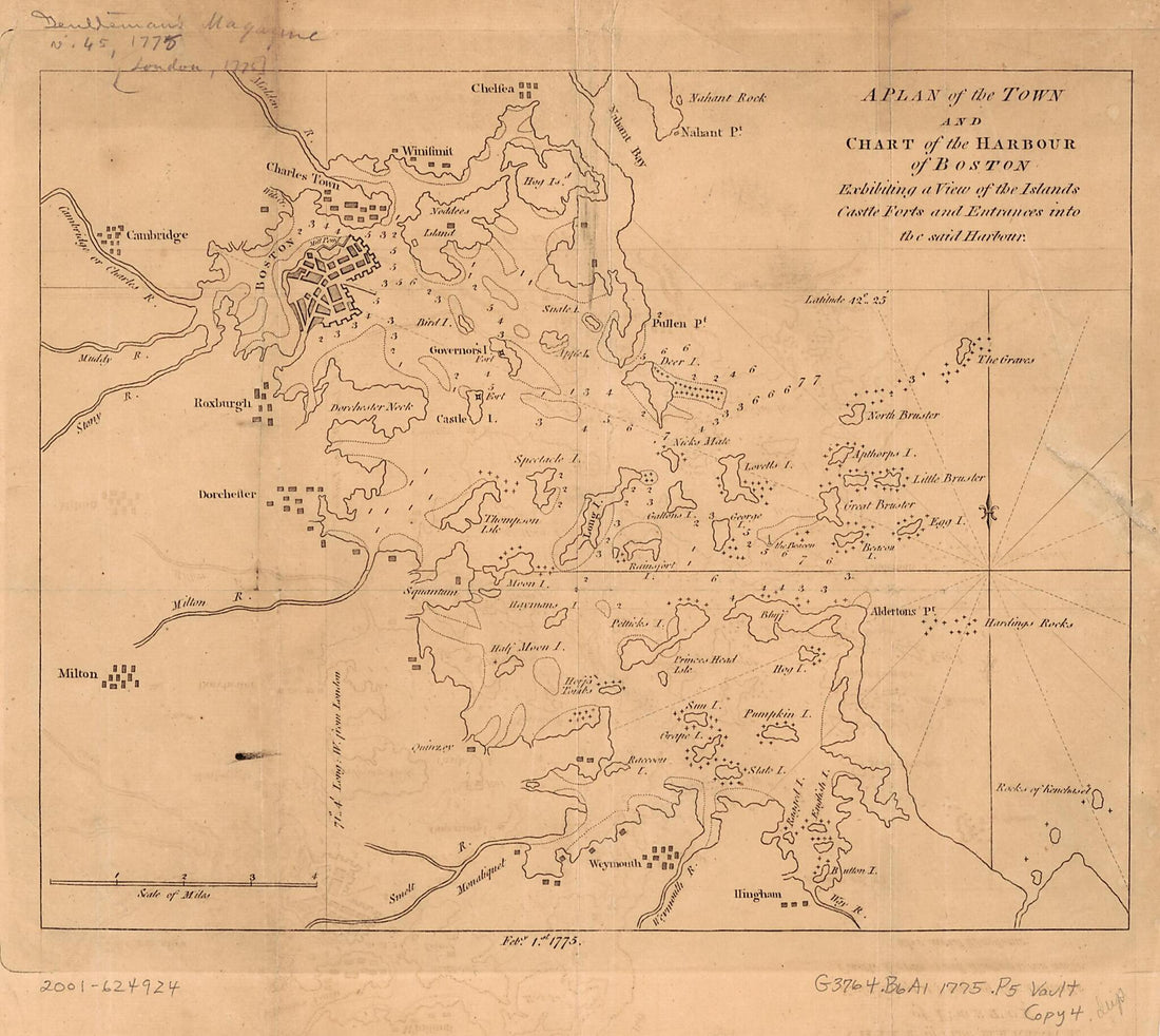 A Plan of the Town and Chart of the Harbour of Boston : Exhibiting a View of the Islands, Castle Forts, and Entrances Into the Said Harbour 1775A Plan of the Town and Chart of the Harbour of Boston : Exhibiting a View of the Islands, Castle Forts, and Entrances Into the Said Harbour 1775
- Regular price
-
$39.95 $83.95 - Regular price
-
$34.95 - Sale price
-
$39.95 $83.95
-
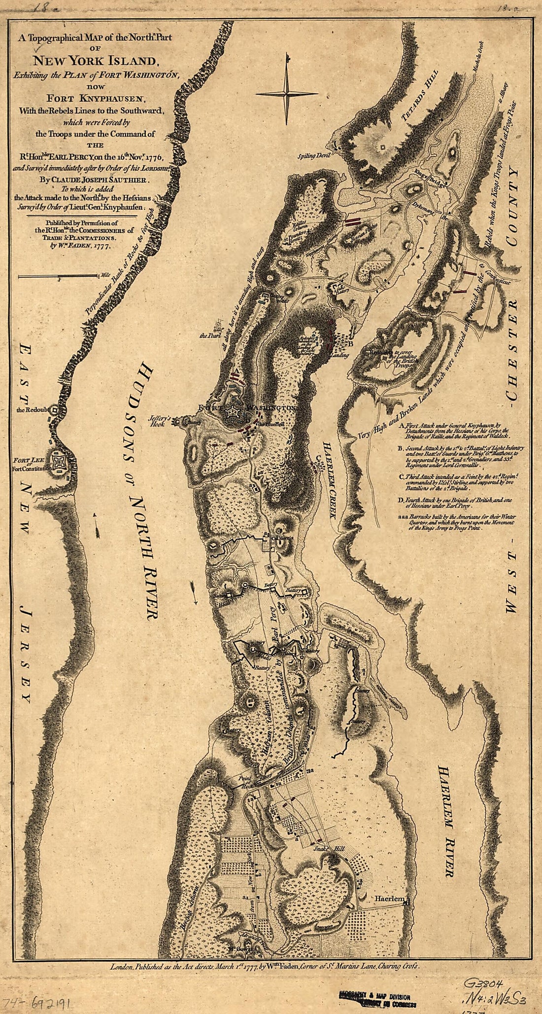 A Topographical Map of the Northn. Part of New York Island, Exhibiting the Plan of Fort Washington, Now Fort Knyphausen, With the Rebels Lines to the Southward, Which Were Forced by the Troops Under the Command of the Rt. Honble. Earl Percy On the 16t...A Topographical Map of the Northn. Part of New York Island, Exhibiting the Plan of Fort Washington, Now Fort Knyphausen, With the Rebels Lines to the Southward, Which Were Forced by the Troops Under the Command of the Rt. Honble. Earl Percy On the 16t...
- Regular price
-
$39.95 $99.95 - Regular price
-
$34.95 - Sale price
-
$39.95 $99.95


