455 products
-
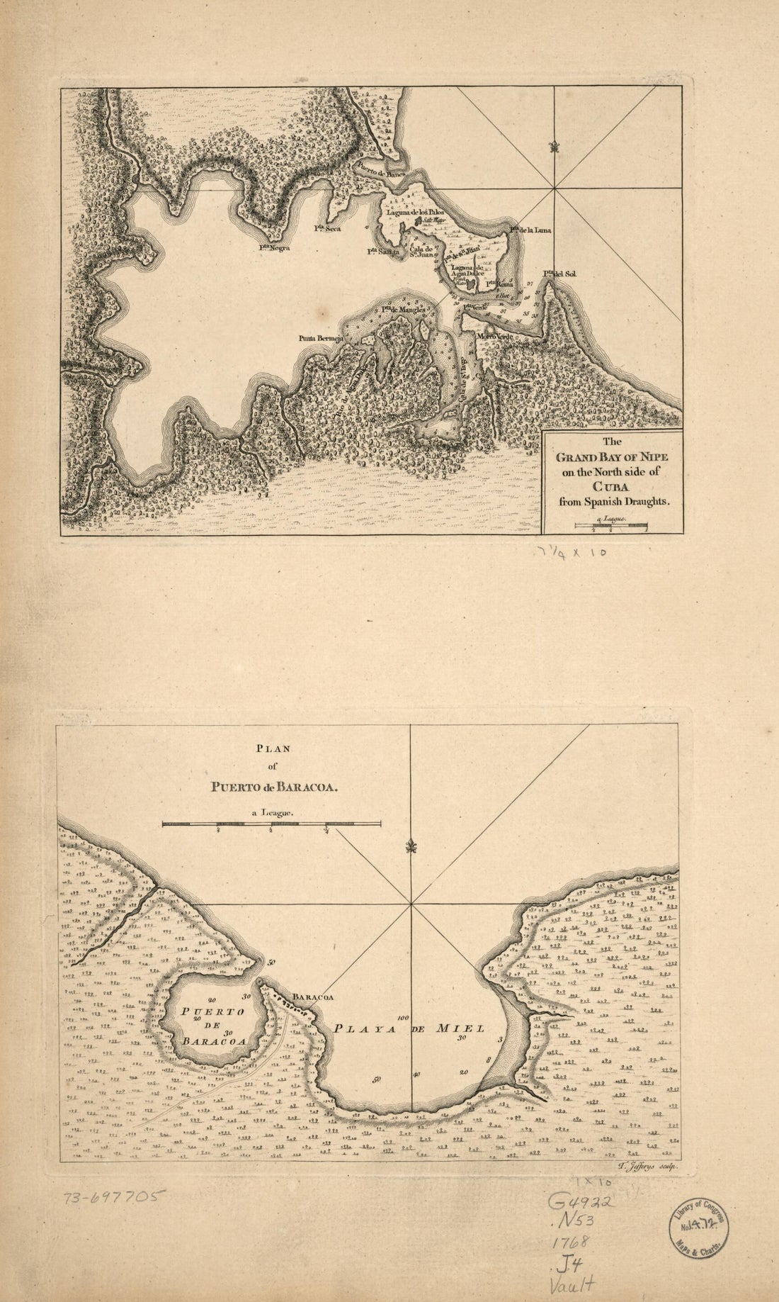 The Grand Bay of Nipe On the North Side of Cuba from Spanish Draughts 1768The Grand Bay of Nipe On the North Side of Cuba from Spanish Draughts 1768
- Regular price
-
$46.95 $99.95 - Regular price
-
$41.95 - Sale price
-
$46.95 $99.95
-
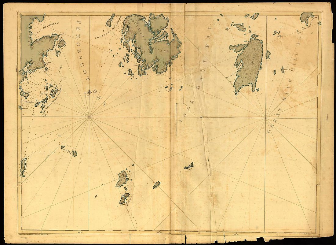 Coast of Maine Showing Entrances of Blue Hill Bay, Isle of Haut Bay, and Penobscot Bay, With Owls Head, Vinalhaven Island, Isle Au Haut, and Other Islands in 1776Coast of Maine Showing Entrances of Blue Hill Bay, Isle of Haut Bay, and Penobscot Bay, With Owls Head, Vinalhaven Island, Isle Au Haut, and Other Islands in 1776
- Regular price
-
$43.95 $156.95 - Regular price
-
$32.95 - Sale price
-
$43.95 $156.95
-
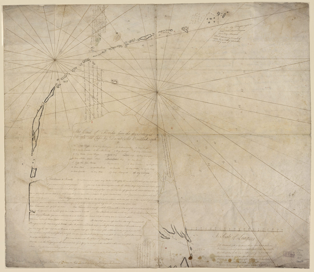 The Coast of Florida from the Dry Tortugas to the Old Cape 1756The Coast of Florida from the Dry Tortugas to the Old Cape 1756
- Regular price
-
$39.95 $165.95 - Regular price
-
$34.95 - Sale price
-
$39.95 $165.95
-
 This Survey of Part of the South Coast of China (South Coast of China) 1807This Survey of Part of the South Coast of China (South Coast of China) 1807
- Regular price
-
$46.95 $221.95 - Regular price
-
$41.95 - Sale price
-
$46.95 $221.95
-
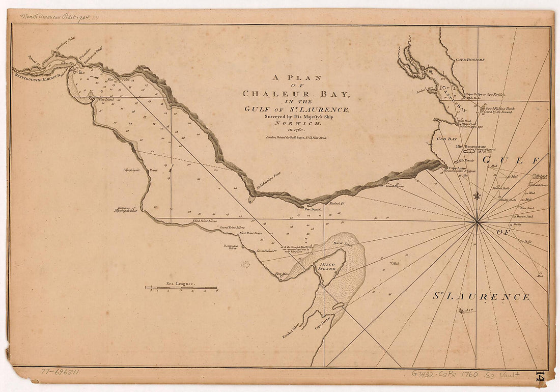 A Plan of Chaleur Bay, In the Gulf of St. Laurence 1780A Plan of Chaleur Bay, In the Gulf of St. Laurence 1780
- Regular price
-
$40.95 $99.95 - Regular price
-
$35.95 - Sale price
-
$40.95 $99.95
-
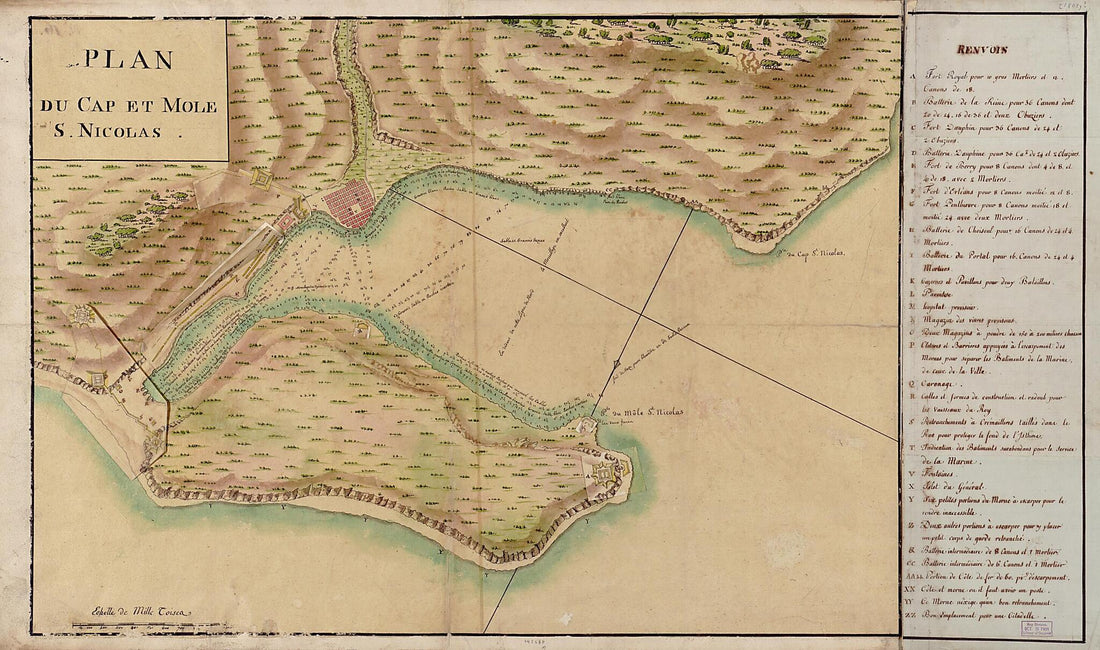 Plan Du Cap Et Mole S. Nicolas 1803Plan Du Cap Et Mole S. Nicolas 1803
- Regular price
-
$46.95 $206.95 - Regular price
-
$41.95 - Sale price
-
$46.95 $206.95
-
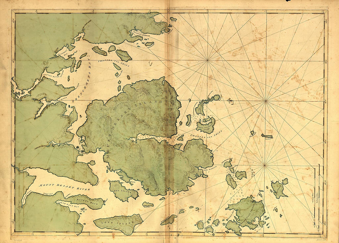 Mount Desert Island and Neighboring Coast of Maine 1776Mount Desert Island and Neighboring Coast of Maine 1776
- Regular price
-
$43.95 $149.95 - Regular price
-
$32.95 - Sale price
-
$43.95 $149.95
-
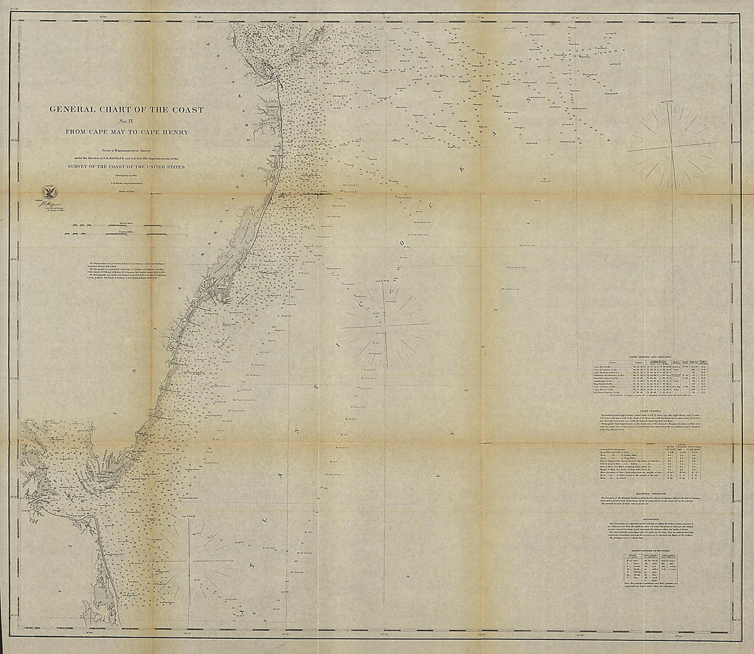 General Chart of the Coast. No. IV, from Cape May to Cape Henry. from a Trigonometrical Survey Under the Direction of F. R. Hassler and A. D. Bache, Superintendents of the Survey of the Coast of the United States 1862General Chart of the Coast. No. IV, from Cape May to Cape Henry. from a Trigonometrical Survey Under the Direction of F. R. Hassler and A. D. Bache, Superintendents of the Survey of the Coast of the United States 1862
- Regular price
-
$39.95 $204.95 - Regular price
-
$34.95 - Sale price
-
$39.95 $204.95
-
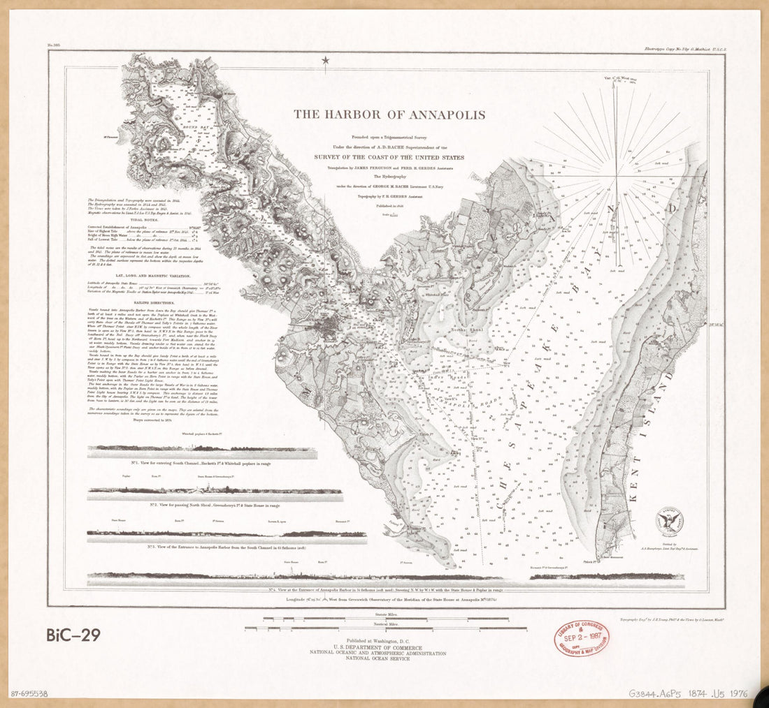 The Harbor of Annapolis : Founded Upon a Trigonometrical Survey 1874The Harbor of Annapolis : Founded Upon a Trigonometrical Survey 1874
- Regular price
-
$39.95 $83.95 - Regular price
-
$34.95 - Sale price
-
$39.95 $83.95
-
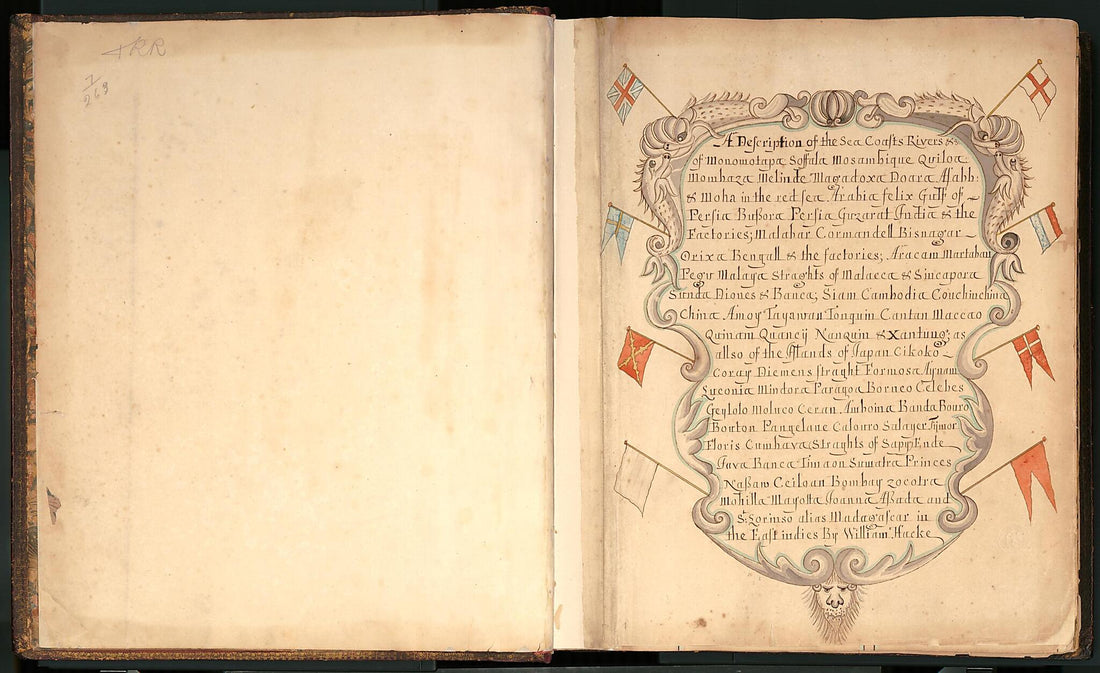 A Description of the Sea Coasts ... In the East Indies (Hack's Descript of Ye East Indies, Buccaneer Atlas) 1690A Description of the Sea Coasts ... In the East Indies (Hack's Descript of Ye East Indies, Buccaneer Atlas) 1690
- Regular price
-
$46.95 $202.95 - Regular price
-
$41.95 - Sale price
-
$46.95 $202.95
-
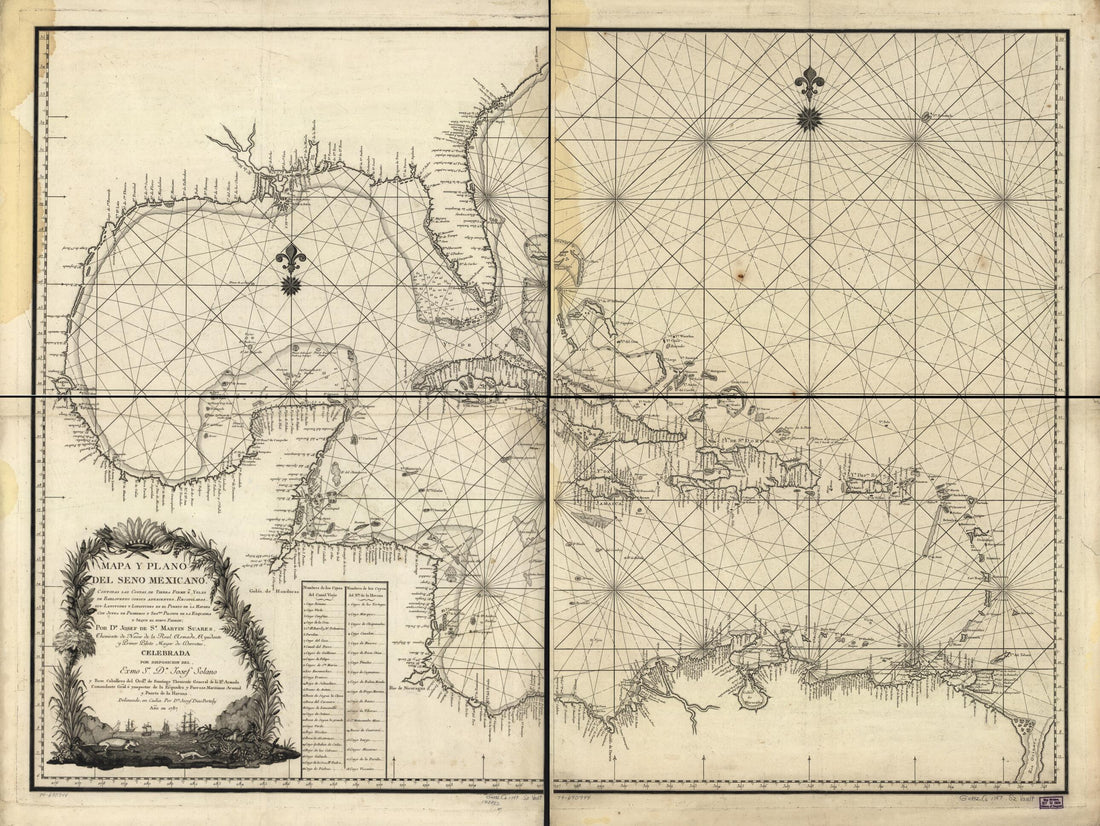 Latitudes Y Longitudes En El Puerto De La Havana Con Junta De Primeros Y Segdos. Pilotos De La Esquadra Y Segun El Neuvo Padron; in 1787Latitudes Y Longitudes En El Puerto De La Havana Con Junta De Primeros Y Segdos. Pilotos De La Esquadra Y Segun El Neuvo Padron; in 1787
- Regular price
-
$43.95 $172.95 - Regular price
-
$32.95 - Sale price
-
$43.95 $172.95
-
 De La Grande Rivière De Canada : Appellée Par Les Europeens De St. Laurens 1715De La Grande Rivière De Canada : Appellée Par Les Europeens De St. Laurens 1715
- Regular price
-
$43.95 $237.95 - Regular price
-
$32.95 - Sale price
-
$43.95 $237.95


