949 products
-
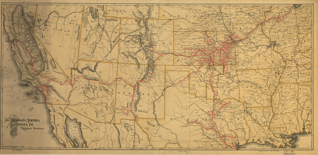 The Atchison, Topeka and the Santa Fe Railroad System, 1899The Atchison, Topeka and the Santa Fe Railroad System, 1899
- Regular price
-
$46.95 $99.95 - Regular price
-
$41.95 - Sale price
-
$46.95 $99.95
-
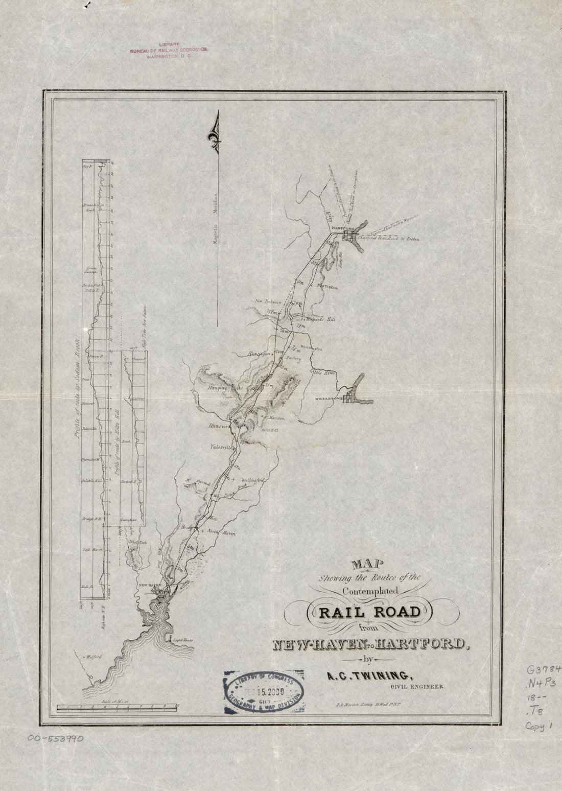 Haven to Hartford 1800Haven to Hartford 1800
- Regular price
-
$39.95 $88.95 - Regular price
-
$34.95 - Sale price
-
$39.95 $88.95
-
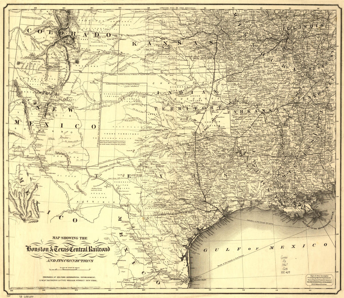 Map Showing the Houston & Texas Central Railroad and Its Connections, Prepared at Colton's Geographic Establishment, New York, 1867Map Showing the Houston & Texas Central Railroad and Its Connections, Prepared at Colton's Geographic Establishment, New York, 1867
- Regular price
-
$43.95 $83.95 - Regular price
-
$38.95 - Sale price
-
$43.95 $83.95
-
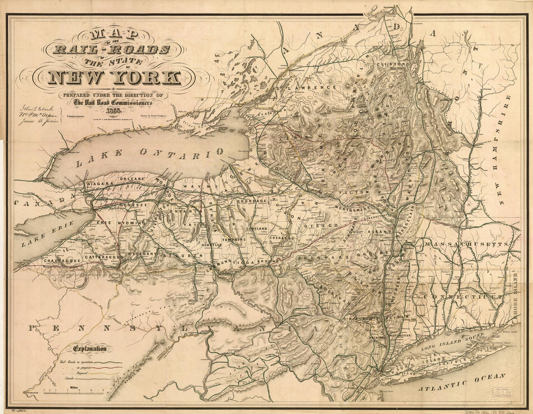 Roads of the State of New York Prepared Under the Direction of the Rail Road Commissioners, John S. Clark, William J. McAlpine, James B. Swain 1856Roads of the State of New York Prepared Under the Direction of the Rail Road Commissioners, John S. Clark, William J. McAlpine, James B. Swain 1856
- Regular price
-
$43.95 $83.95 - Regular price
-
$38.95 - Sale price
-
$43.95 $83.95
-
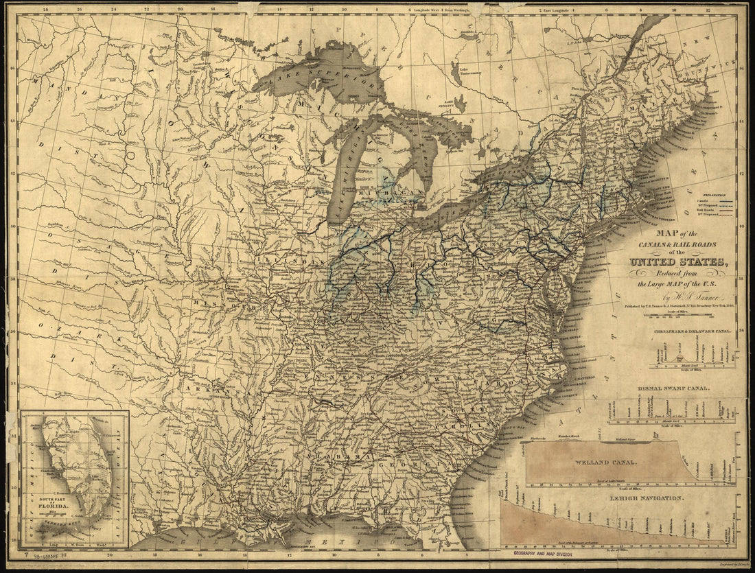 Map of the Canals & Rail Roads of the United States, Reduced from the Large Map of the U.S.; Engraved by J. Knight 1840Map of the Canals & Rail Roads of the United States, Reduced from the Large Map of the U.S.; Engraved by J. Knight 1840
- Regular price
-
$43.95 $88.95 - Regular price
-
$38.95 - Sale price
-
$43.95 $88.95
-
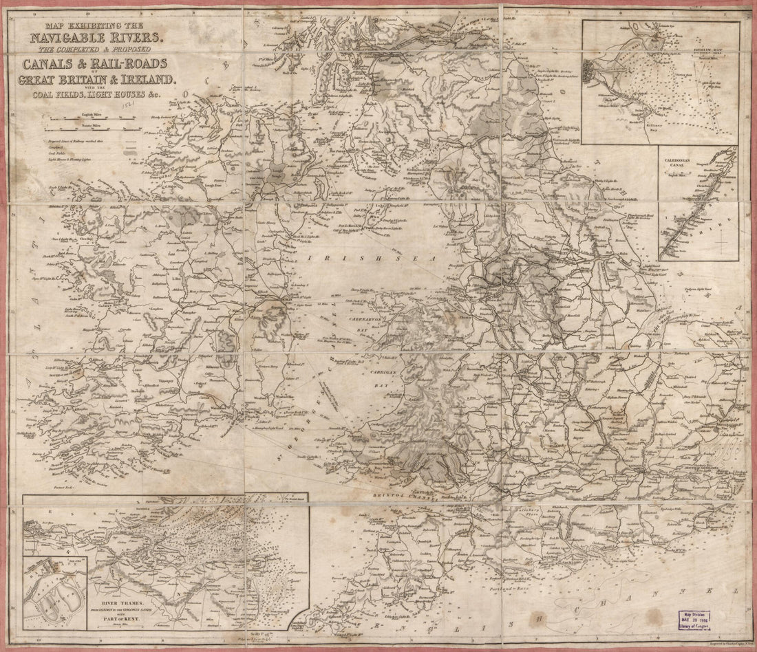 Roads of Great Britain & Ireland : With the Coal Fields, Light Houses &c 1861Roads of Great Britain & Ireland : With the Coal Fields, Light Houses &c 1861
- Regular price
-
$43.95 $83.95 - Regular price
-
$38.95 - Sale price
-
$43.95 $83.95
-
 Railroad Map Showing the Lands of the Standard Coal and Iron County Situated In the Hocking Valley, Ohio, and Their Relation to the Markets of the North and West 1881Railroad Map Showing the Lands of the Standard Coal and Iron County Situated In the Hocking Valley, Ohio, and Their Relation to the Markets of the North and West 1881
- Regular price
-
$43.95 $223.95 - Regular price
-
$38.95 - Sale price
-
$43.95 $223.95
-
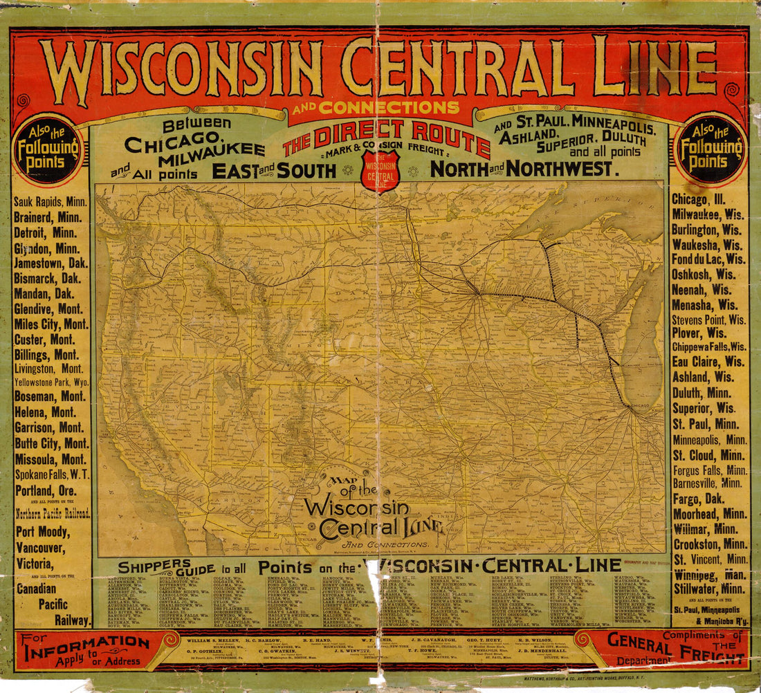 Map of the Wisconsin Central Line and Connections 1880Map of the Wisconsin Central Line and Connections 1880
- Regular price
-
$43.95 $89.95 - Regular price
-
$38.95 - Sale price
-
$43.95 $89.95
-
 Continental Map of the Pacific Railroad and Routes of Overland Travel to Colorado, Nebraska, the Black Hills, Utah, Idaho, Nevada, Montana, California and the Pacific Coast 1877Continental Map of the Pacific Railroad and Routes of Overland Travel to Colorado, Nebraska, the Black Hills, Utah, Idaho, Nevada, Montana, California and the Pacific Coast 1877
- Regular price
-
$46.95 $178.95 - Regular price
-
$41.95 - Sale price
-
$46.95 $178.95
-
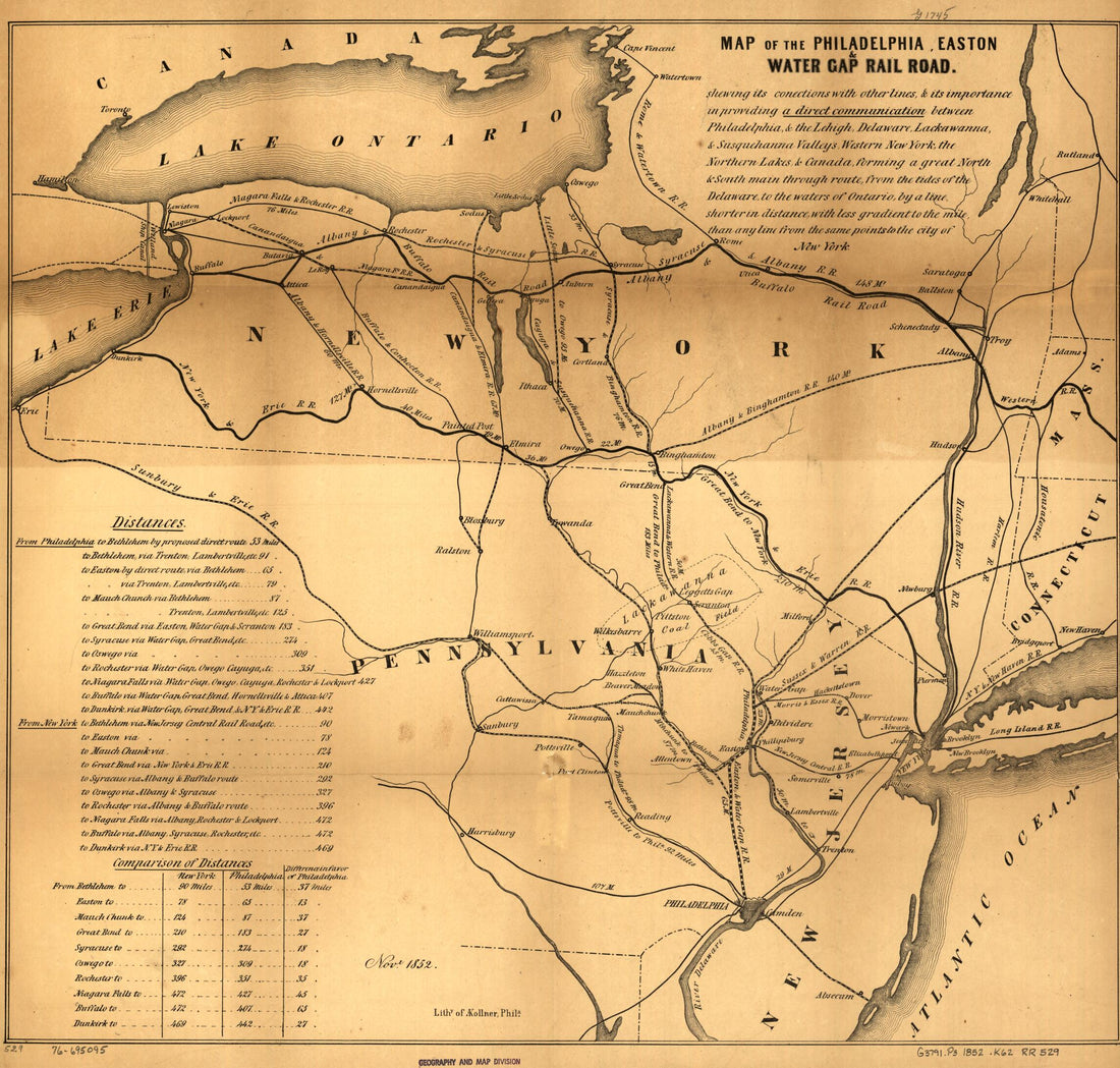 Map of the Philadelphia, Easton & Water Gap Rail Road 1852Map of the Philadelphia, Easton & Water Gap Rail Road 1852
- Regular price
-
$43.95 $83.95 - Regular price
-
$38.95 - Sale price
-
$43.95 $83.95
-
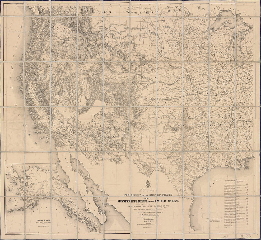 Territory of the United States From the Mississippi River to the Pacific Ocean; Originally Prepared to Accompany the Reports of the Explorations for a Pacific Railroad Route in 1868Territory of the United States From the Mississippi River to the Pacific Ocean; Originally Prepared to Accompany the Reports of the Explorations for a Pacific Railroad Route in 1868
- Regular price
-
$43.95 $213.95 - Regular price
-
$38.95 - Sale price
-
$43.95 $213.95
-
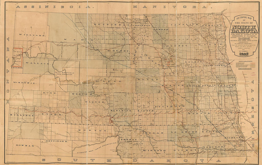 Sectional Map of the State of North Dakota Published by Authority of the Commissioners of Railroads Under the Direction of the Governor; Drawn and Compiled From Official Maps of the General Land Office and Other Authentic Sources in 1892Sectional Map of the State of North Dakota Published by Authority of the Commissioners of Railroads Under the Direction of the Governor; Drawn and Compiled From Official Maps of the General Land Office and Other Authentic Sources in 1892
- Regular price
-
$46.95 $200.95 - Regular price
-
$41.95 - Sale price
-
$46.95 $200.95


