949 products
-
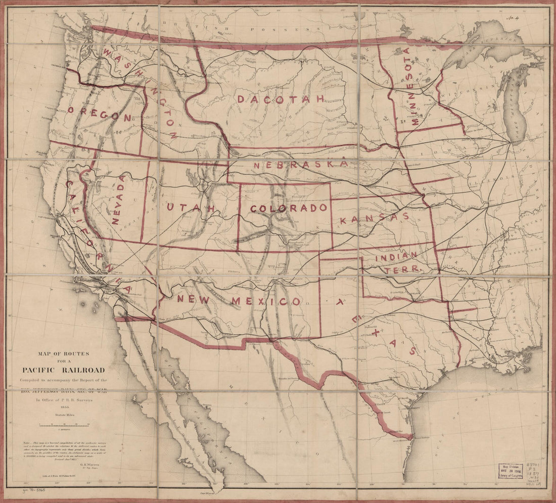 Map of Routes for a Pacific Railroad, Compiled to Accompany the Report of the Hon. Jefferson Davis, Sec. of War 1855Map of Routes for a Pacific Railroad, Compiled to Accompany the Report of the Hon. Jefferson Davis, Sec. of War 1855
- Regular price
-
$39.95 $83.95 - Regular price
-
$34.95 - Sale price
-
$39.95 $83.95
-
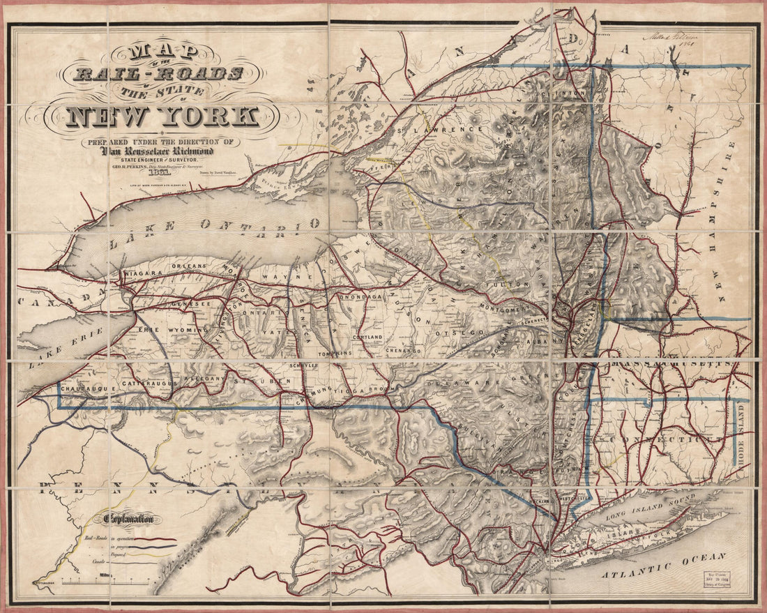
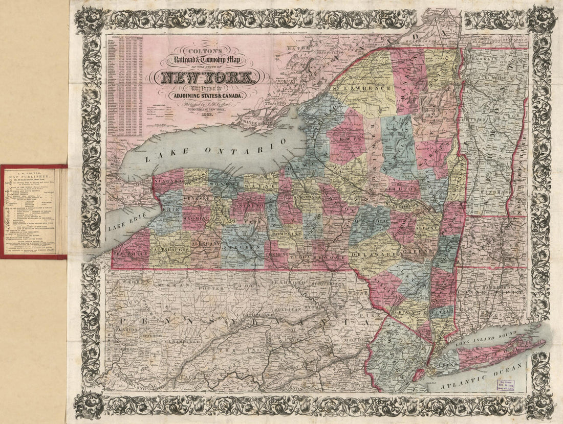 Colton's Railroad & Township Map of the State of New York : With Parts of the Adjoining States & Canada (Colton's Railroad and Township Map of the State of New York, Railroad & Township Map of the State of New York, Township Map of the State of New Yo...Colton's Railroad & Township Map of the State of New York : With Parts of the Adjoining States & Canada (Colton's Railroad and Township Map of the State of New York, Railroad & Township Map of the State of New York, Township Map of the State of New Yo...
- Regular price
-
$43.95 $90.95 - Regular price
-
$32.95 - Sale price
-
$43.95 $90.95
-
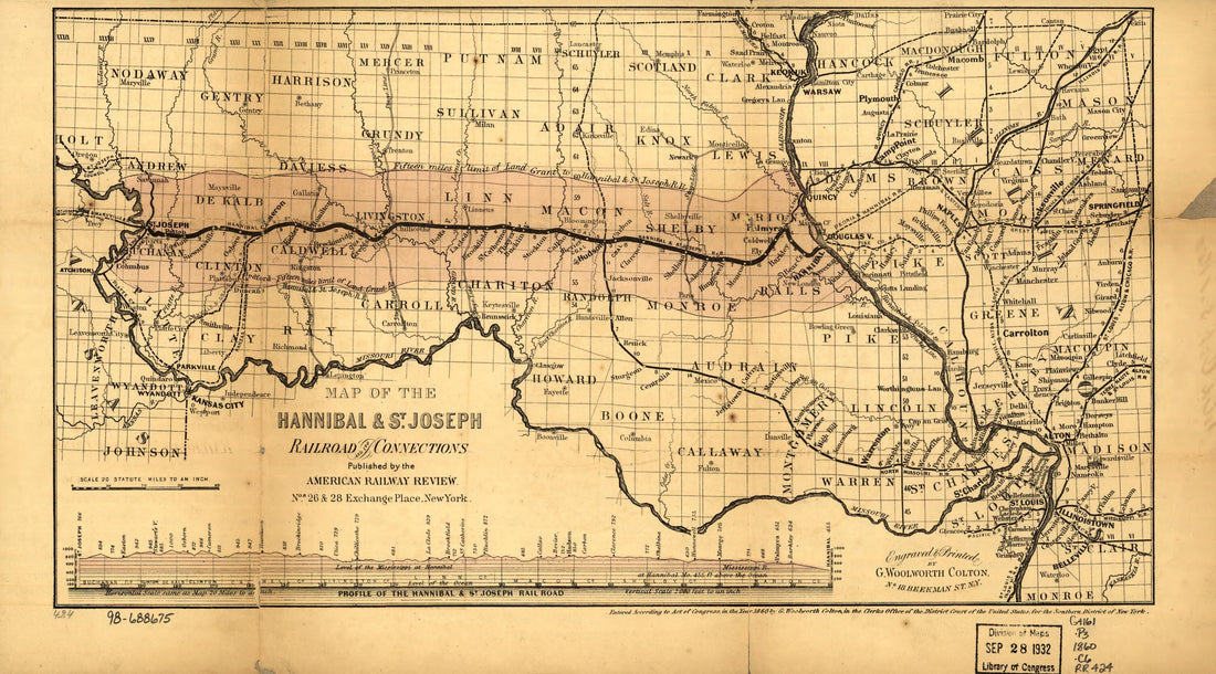 Map of the Hannibal & St. Joseph Railroad and Its Connections Published by the American Railway Review, New York 1860Map of the Hannibal & St. Joseph Railroad and Its Connections Published by the American Railway Review, New York 1860
- Regular price
-
$39.95 $99.95 - Regular price
-
$29.95 - Sale price
-
$39.95 $99.95
-
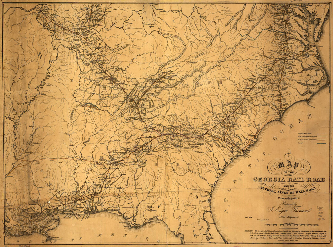 A Map of the Georgia Rail Road and the Several Lines of Railroad Connecting With It, Febr. 1839A Map of the Georgia Rail Road and the Several Lines of Railroad Connecting With It, Febr. 1839
- Regular price
-
$43.95 $88.95 - Regular price
-
$32.95 - Sale price
-
$43.95 $88.95
-
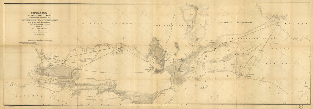 General Map of a Survey In California : In Connection With Examinations for Railroad Routes to the Pacific Ocean in 1855General Map of a Survey In California : In Connection With Examinations for Railroad Routes to the Pacific Ocean in 1855
- Regular price
-
$46.95 $179.95 - Regular price
-
$41.95 - Sale price
-
$46.95 $179.95
-
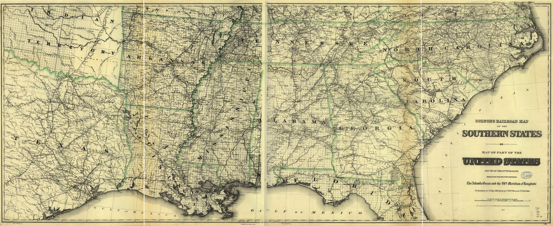 Colton's Railroad Map of Part of the United States South of the 37th Parallel Embracing the Country Between the Atlantic Ocean and the 96th Meridian of Longitude in 1883Colton's Railroad Map of Part of the United States South of the 37th Parallel Embracing the Country Between the Atlantic Ocean and the 96th Meridian of Longitude in 1883
- Regular price
-
$46.95 $210.95 - Regular price
-
$41.95 - Sale price
-
$46.95 $210.95
-
 Map Showing the Coal & Timber Lands of the Allegheny Rail Road & Coal Company With the Avenues to Market 1850Map Showing the Coal & Timber Lands of the Allegheny Rail Road & Coal Company With the Avenues to Market 1850
- Regular price
-
$43.95 $99.95 - Regular price
-
$31.95 - Sale price
-
$43.95 $99.95
-
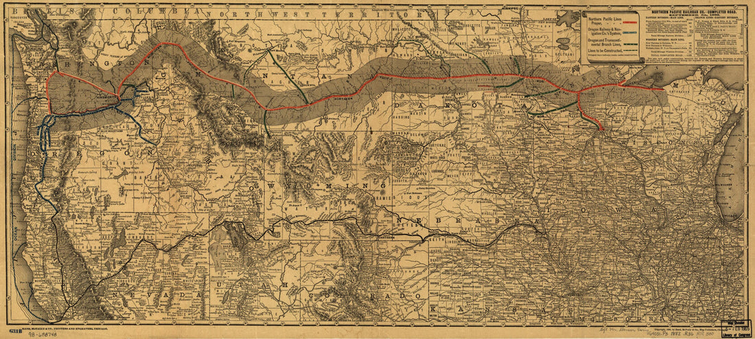 United States, West 1882United States, West 1882
- Regular price
-
$46.95 $99.95 - Regular price
-
$41.95 - Sale price
-
$46.95 $99.95
-
 Roads of the State of New York 1861Roads of the State of New York 1861
- Regular price
-
$39.95 $83.95 - Regular price
-
$34.95 - Sale price
-
$39.95 $83.95
-
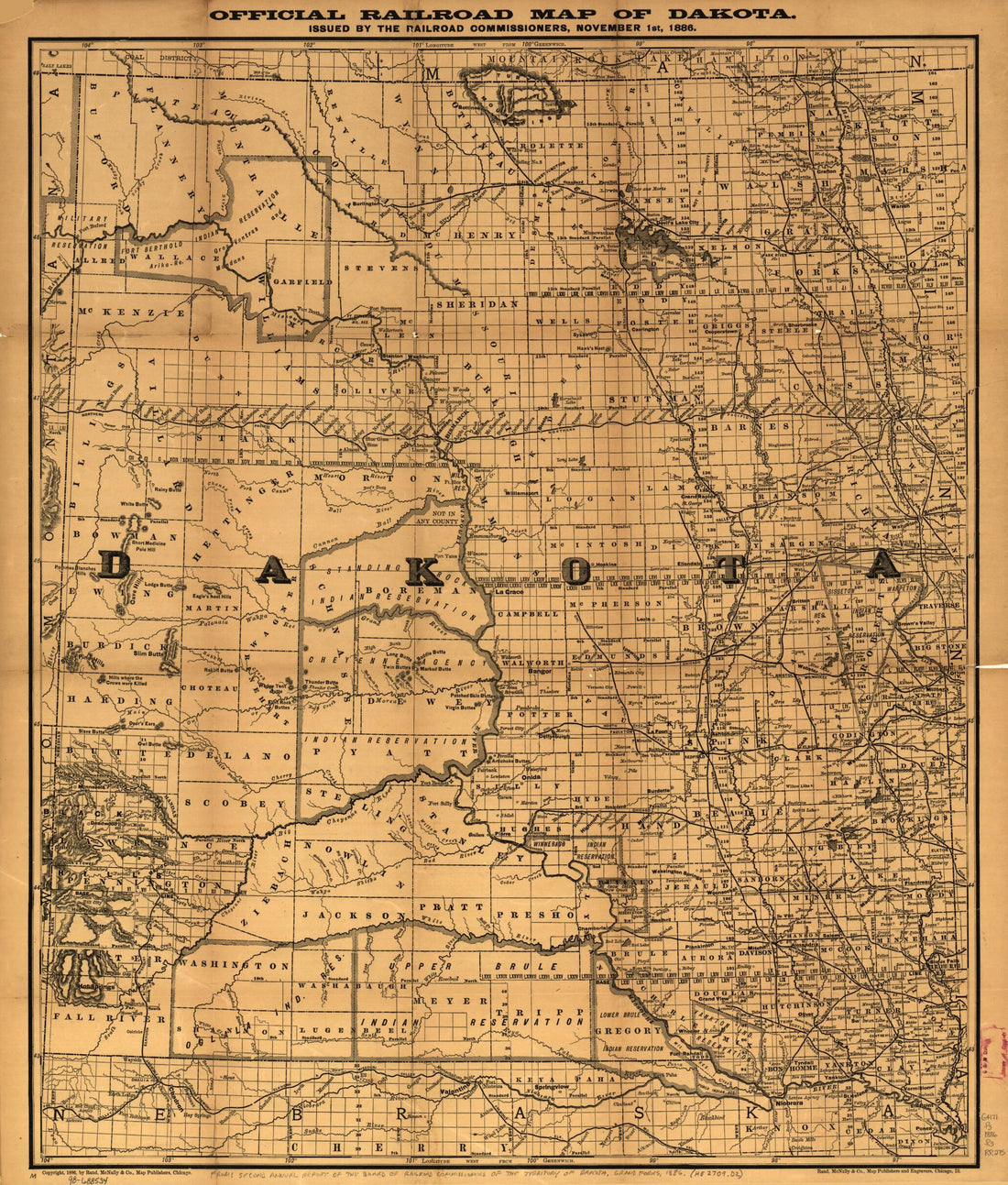 Official Railroad Map of Dakota Issued by the Railroad Commissioners, November 1st, 1886Official Railroad Map of Dakota Issued by the Railroad Commissioners, November 1st, 1886
- Regular price
-
$39.95 $83.95 - Regular price
-
$34.95 - Sale price
-
$39.95 $83.95
-
 Kentucky 1905Kentucky 1905
- Regular price
-
$39.95 $83.95 - Regular price
-
$29.95 - Sale price
-
$39.95 $83.95
-
 Map Showing the Route of the Washington and Atlantic Railroad and Its Connections 1883Map Showing the Route of the Washington and Atlantic Railroad and Its Connections 1883
- Regular price
-
$43.95 $88.95 - Regular price
-
$32.95 - Sale price
-
$43.95 $88.95


