1310 products
-
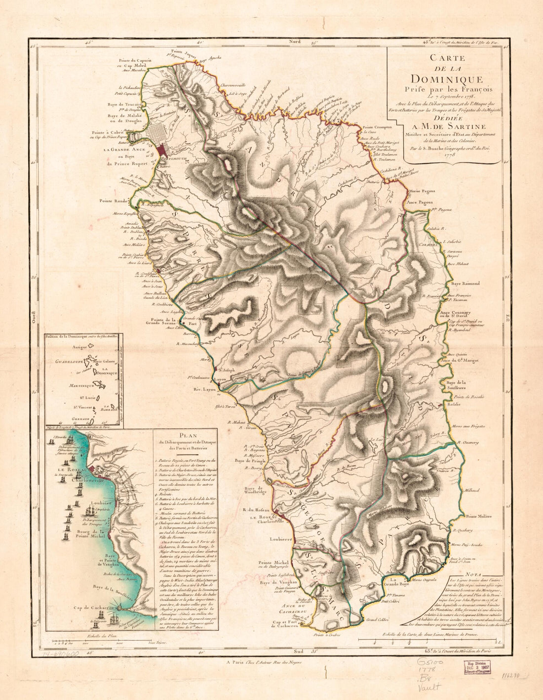 Carte De La Dominique, Prise Par Les François Le 7 Septembre 1778. Avec Le Plan Du Débarquement, Et De L'attague Des Forts Et Batteries Par Les Troupes Et Les Frégates De Sa Majesté. Dédiée a M. De Sartine, Ministre Et Secrétaire D'État Au Dé...Carte De La Dominique, Prise Par Les François Le 7 Septembre 1778. Avec Le Plan Du Débarquement, Et De L'attague Des Forts Et Batteries Par Les Troupes Et Les Frégates De Sa Majesté. Dédiée a M. De Sartine, Ministre Et Secrétaire D'État Au Dé...
- Regular price
-
$43.95 $83.95 - Regular price
-
$38.95 - Sale price
-
$43.95 $83.95
-
 A New Map of Jamaica; In Which the Several Towns, Forts, & Settlements Are Accurately Laid Down, As Well As the Situations & Depths of the Most Noted Harbours and Anchoring Places 1771A New Map of Jamaica; In Which the Several Towns, Forts, & Settlements Are Accurately Laid Down, As Well As the Situations & Depths of the Most Noted Harbours and Anchoring Places 1771
- Regular price
-
$43.95 $204.95 - Regular price
-
$38.95 - Sale price
-
$43.95 $204.95
-
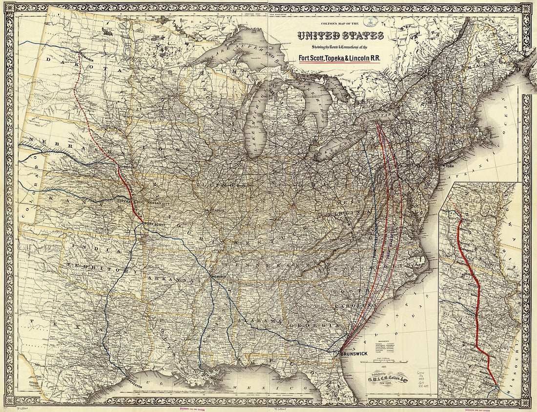 Colton's Map of the United States Showing the Route & Connections of the Fort Scott, Topeka & Lincoln R.R 1883Colton's Map of the United States Showing the Route & Connections of the Fort Scott, Topeka & Lincoln R.R 1883
- Regular price
-
$43.95 $130.95 - Regular price
-
$38.95 - Sale price
-
$43.95 $130.95
-
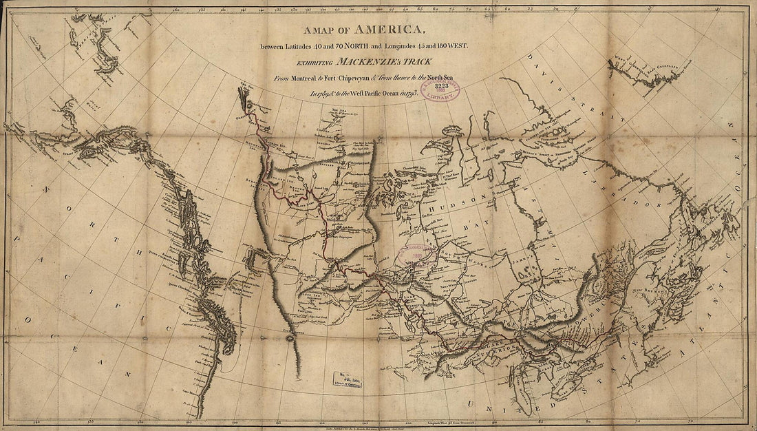 A Map of America Between Latitudes 40 and 70 North and Longitudes 45 and 180 West Exhibiting Mackenzie's Track from Montreal to Fort Chipewyan & from Thence to the North Sea In 1789 & to the West Pacific Ocean In 1793 1801A Map of America Between Latitudes 40 and 70 North and Longitudes 45 and 180 West Exhibiting Mackenzie's Track from Montreal to Fort Chipewyan & from Thence to the North Sea In 1789 & to the West Pacific Ocean In 1793 1801
- Regular price
-
$46.95 $99.95 - Regular price
-
$41.95 - Sale price
-
$46.95 $99.95
-
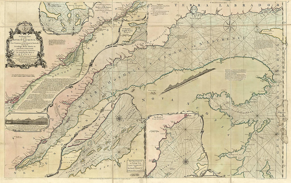 An Exact Chart of the River St. Laurence, from Fort Frontenac to the Island of Anticosti Shewing the Soundings, Rocks, Shoals &c With Views of the Lands and All Necessary Instructions for Navigating That River to Quebec 1771An Exact Chart of the River St. Laurence, from Fort Frontenac to the Island of Anticosti Shewing the Soundings, Rocks, Shoals &c With Views of the Lands and All Necessary Instructions for Navigating That River to Quebec 1771
- Regular price
-
$46.95 $212.95 - Regular price
-
$41.95 - Sale price
-
$46.95 $212.95
-
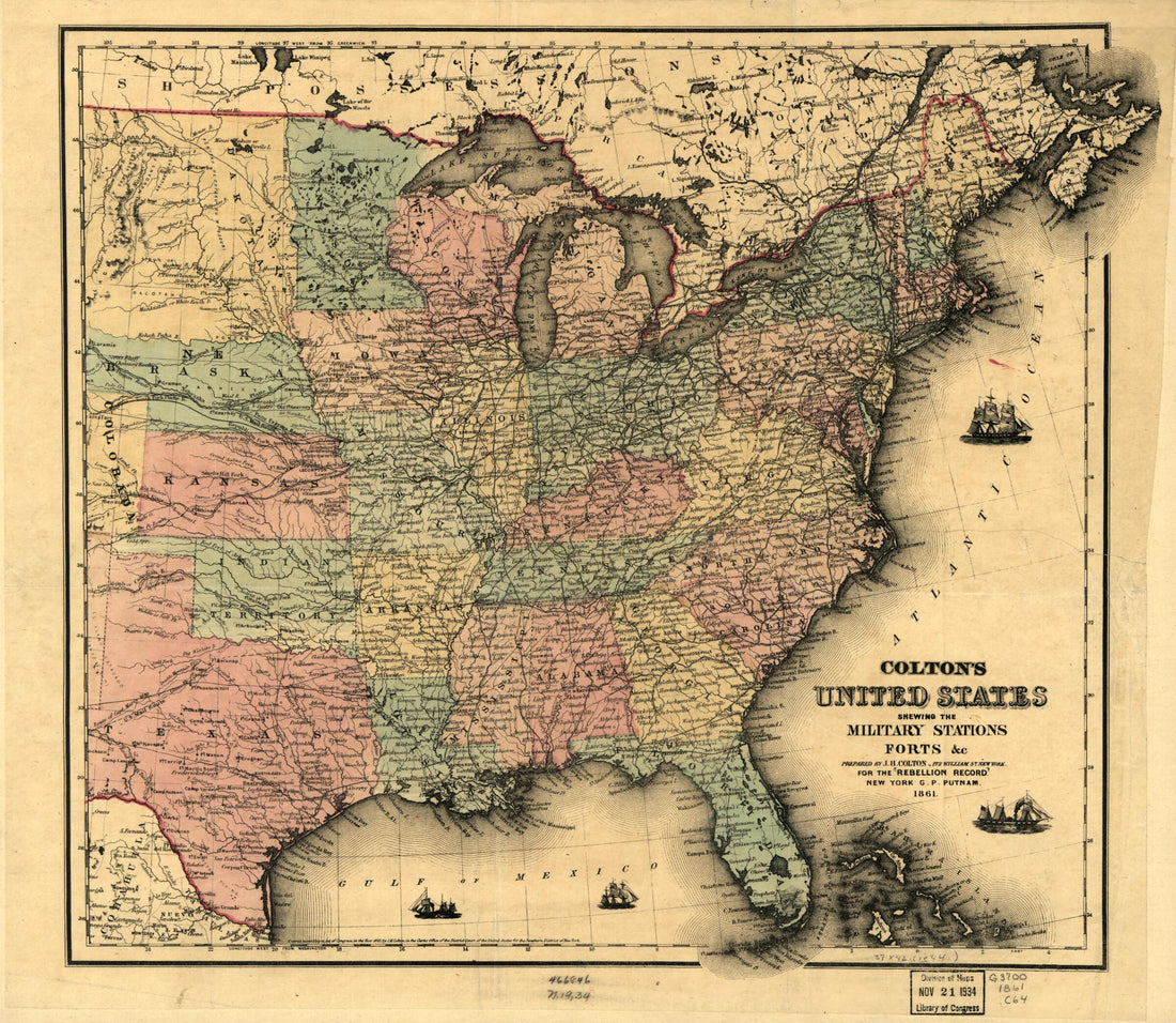 Colton's United States Shewing the Military Stations, Forts, &c 1861Colton's United States Shewing the Military Stations, Forts, &c 1861
- Regular price
-
$43.95 $83.95 - Regular price
-
$31.95 - Sale price
-
$43.95 $83.95
-
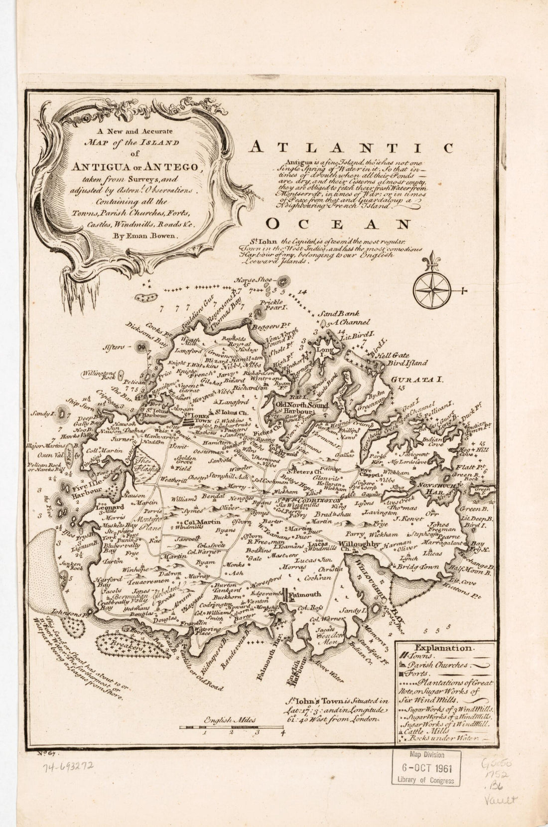 A New and Accurate Map of the Island of Antigua Or Antego, Taken from Surveys, and Adjusted by Astronl. Observations. Containing All the Towns, Parish Churches, Forts, Castles, Windmills, Roads &c 1752A New and Accurate Map of the Island of Antigua Or Antego, Taken from Surveys, and Adjusted by Astronl. Observations. Containing All the Towns, Parish Churches, Forts, Castles, Windmills, Roads &c 1752
- Regular price
-
$39.95 $99.95 - Regular price
-
$34.95 - Sale price
-
$39.95 $99.95
-
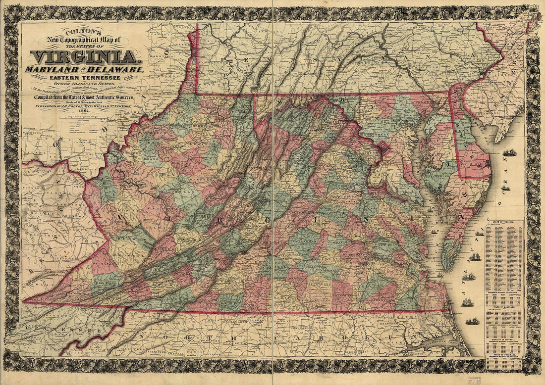 Colton's New Topographical Map of the States of Virginia, Maryland and Delaware, Showing Also Eastern Tennessee & Parts of Other Adjoining States, All the Fortifications, Military Stations, Rail Roads, Common Roads and Other Internal Improvements 1862Colton's New Topographical Map of the States of Virginia, Maryland and Delaware, Showing Also Eastern Tennessee & Parts of Other Adjoining States, All the Fortifications, Military Stations, Rail Roads, Common Roads and Other Internal Improvements 1862
- Regular price
-
$43.95 $150.95 - Regular price
-
$38.95 - Sale price
-
$43.95 $150.95
-
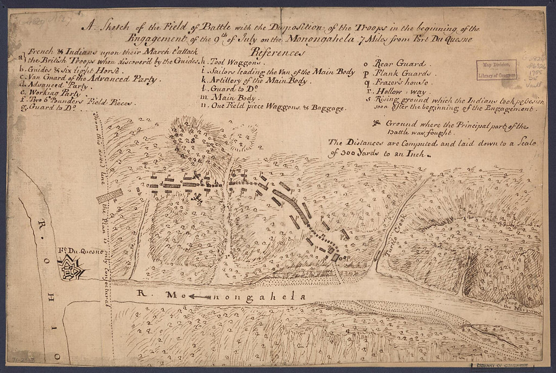 A Sketch of the Field of Battle With the Disposition of the Troops In the Beginning of the Engagement of the 9th of July On the Monongahela 7 Miles from Fort Du Quesne 1755A Sketch of the Field of Battle With the Disposition of the Troops In the Beginning of the Engagement of the 9th of July On the Monongahela 7 Miles from Fort Du Quesne 1755
- Regular price
-
$39.95 $99.95 - Regular price
-
$34.95 - Sale price
-
$39.95 $99.95
-
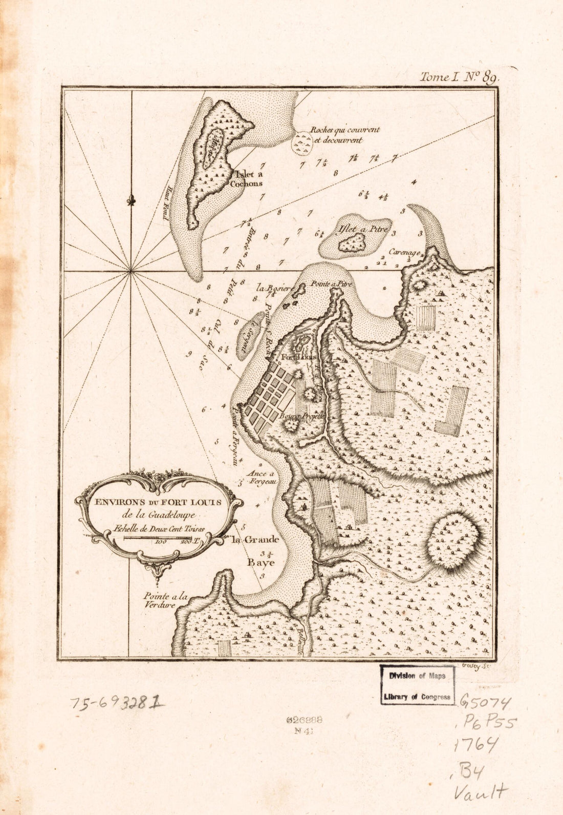 Environs Du Fort Louis De La Guadeloupe 1764Environs Du Fort Louis De La Guadeloupe 1764
- Regular price
-
$39.95 $99.95 - Regular price
-
$34.95 - Sale price
-
$39.95 $99.95
-
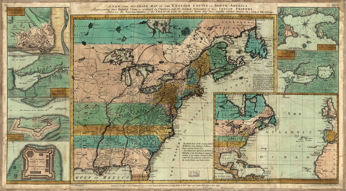 A New and Accurate Map of the English Empire In North America; Representing Their Rightful Claim As Confirmed by Charters and the Formal Surrender of Their Indian Friends; Likewise the Encroachments of the French, With the Several Forts They Have Unju...A New and Accurate Map of the English Empire In North America; Representing Their Rightful Claim As Confirmed by Charters and the Formal Surrender of Their Indian Friends; Likewise the Encroachments of the French, With the Several Forts They Have Unju...
- Regular price
-
$46.95 $99.95 - Regular price
-
$41.95 - Sale price
-
$46.95 $99.95
-
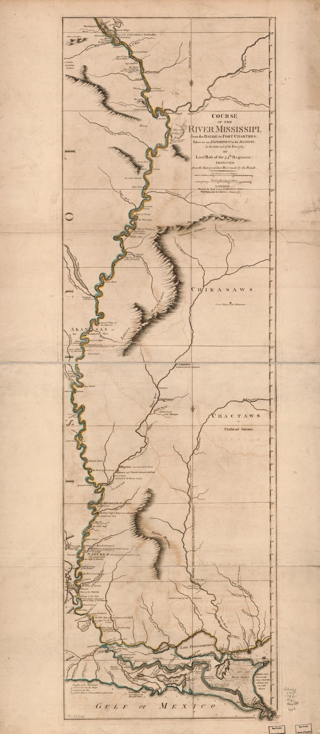 Course of the River Mississipi From the Balise to Fort Chartres; Taken On an Expedition to the Illinois, In the Latter End of the Year 1765 in 1780Course of the River Mississipi From the Balise to Fort Chartres; Taken On an Expedition to the Illinois, In the Latter End of the Year 1765 in 1780
- Regular price
-
$46.95 $99.95 - Regular price
-
$41.95 - Sale price
-
$46.95 $99.95


