1310 products
-
 Map of Mobile Point & Part of the Bay & of Dauphine Island Shewing the Position of the British Land & Naval Forces Investing Fort Bowyer, the Batteries Erected and the Trenches Opened When the Summon Was Made to the Garrison 1815Map of Mobile Point & Part of the Bay & of Dauphine Island Shewing the Position of the British Land & Naval Forces Investing Fort Bowyer, the Batteries Erected and the Trenches Opened When the Summon Was Made to the Garrison 1815
- Regular price
-
$39.95 $99.95 - Regular price
-
$29.95 - Sale price
-
$39.95 $99.95
-
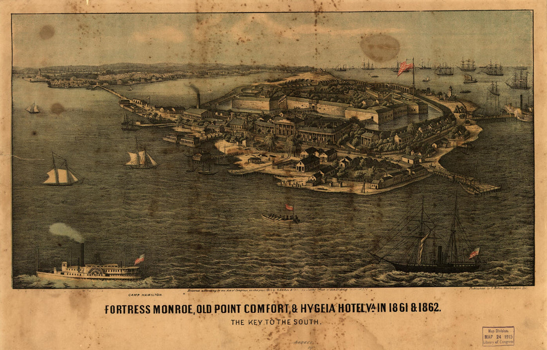 Fortress Monroe, Old Point Comfort, & Hygeia Hotel, Va. In 1861 & 1862. the Key to the SouthFortress Monroe, Old Point Comfort, & Hygeia Hotel, Va. In 1861 & 1862. the Key to the South
- Regular price
-
$39.95 $99.95 - Regular price
-
$29.95 - Sale price
-
$39.95 $99.95
-
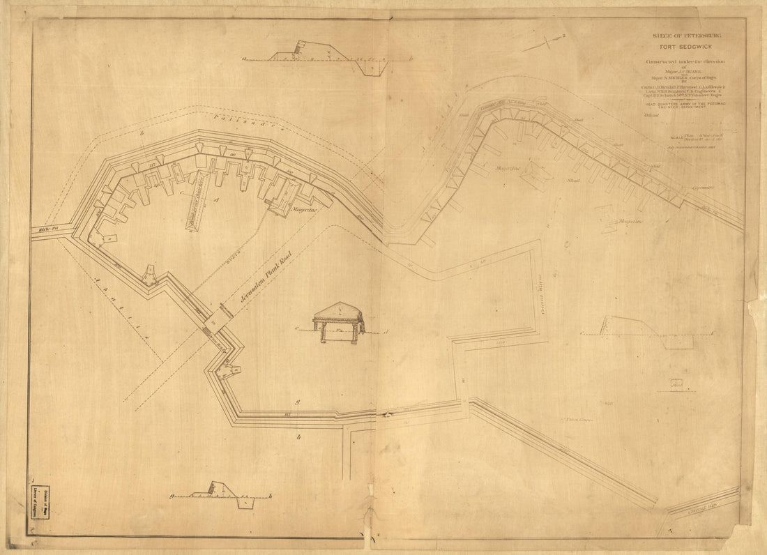 Fort Sedgwick 1864Fort Sedgwick 1864
- Regular price
-
$43.95 $88.95 - Regular price
-
$32.95 - Sale price
-
$43.95 $88.95
-
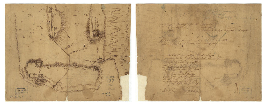 Fort La Fayette On Verplancks Point, With British and Hessian Troop Positions 1779Fort La Fayette On Verplancks Point, With British and Hessian Troop Positions 1779
- Regular price
-
$39.95 $99.95 - Regular price
-
$29.95 - Sale price
-
$39.95 $99.95
-
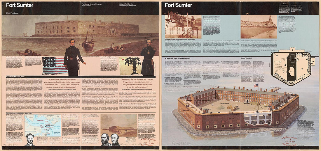
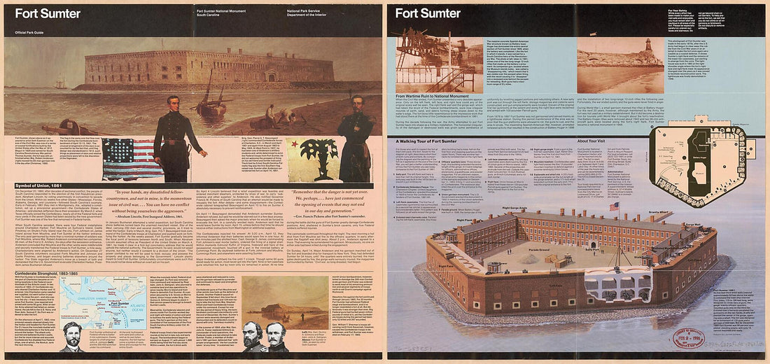 Fort Sumter (Fort Sumter, Fort Sumter National Monument, South Carolina, Official Park Guide) 1861Fort Sumter (Fort Sumter, Fort Sumter National Monument, South Carolina, Official Park Guide) 1861
- Regular price
-
$46.95 $125.95 - Regular price
-
$41.95 - Sale price
-
$46.95 $125.95
-
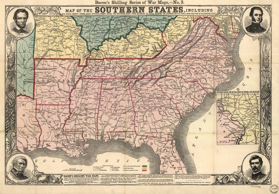 Map of the Southern States, Including Rail Roads, County Towns, State Capitals, Count Roads, the Southern Coast From Delaware to Texas, Showing the Harbors, Inlets, Forts and Position of Blockading Ships in 1863Map of the Southern States, Including Rail Roads, County Towns, State Capitals, Count Roads, the Southern Coast From Delaware to Texas, Showing the Harbors, Inlets, Forts and Position of Blockading Ships in 1863
- Regular price
-
$46.95 $99.95 - Regular price
-
$41.95 - Sale price
-
$46.95 $99.95
-
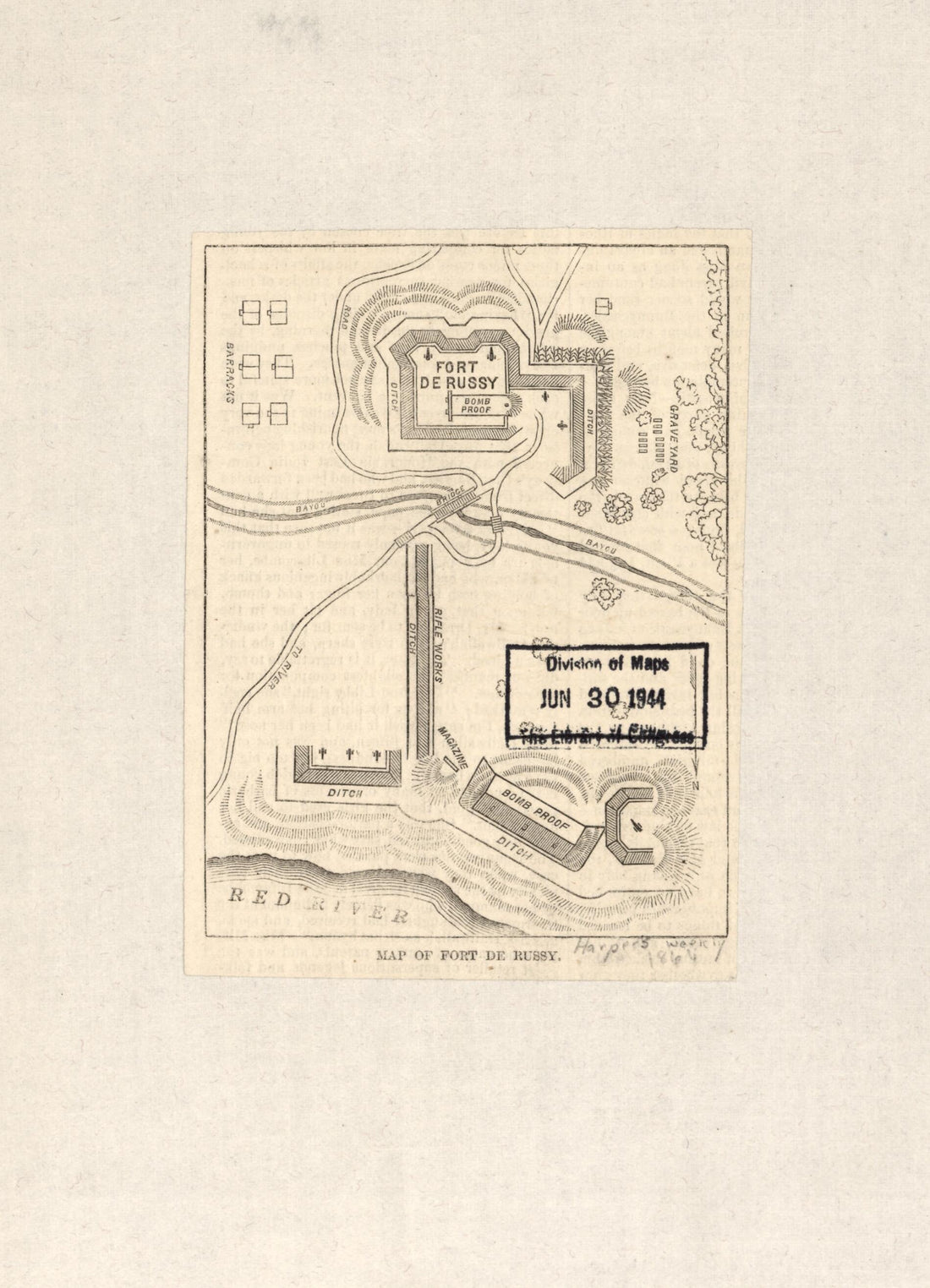 Map of Fort De Russy in 1864Map of Fort De Russy in 1864
- Regular price
-
$39.95 $88.95 - Regular price
-
$29.95 - Sale price
-
$39.95 $88.95
-
 Fort Sumter (Fort Sumter, Fort Sumter National Monument, South Carolina, Official Park Guide) 1861Fort Sumter (Fort Sumter, Fort Sumter National Monument, South Carolina, Official Park Guide) 1861
- Regular price
-
$46.95 $124.95 - Regular price
-
$41.95 - Sale price
-
$46.95 $124.95
-
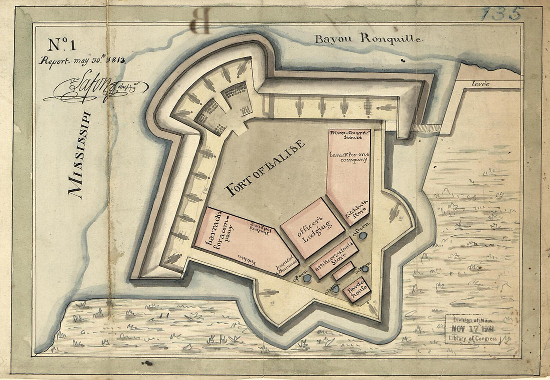 Fort of Balise, No. 1 Report May 30th 1813 (Fort of Balise, Number One Report May 30th 1813)Fort of Balise, No. 1 Report May 30th 1813 (Fort of Balise, Number One Report May 30th 1813)
- Regular price
-
$39.95 $99.95 - Regular price
-
$29.95 - Sale price
-
$39.95 $99.95
-
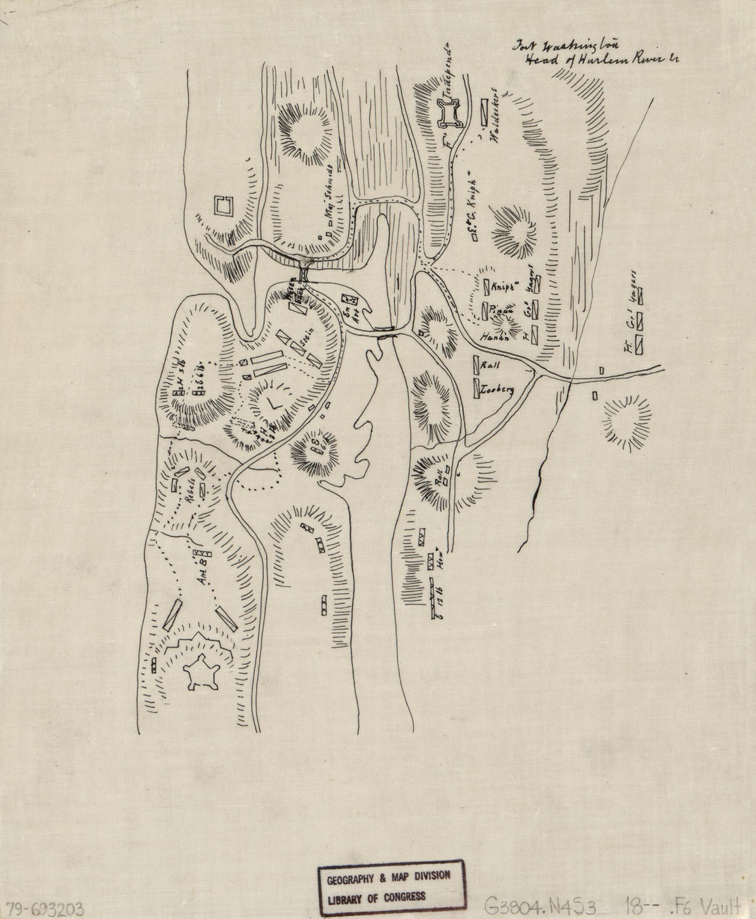 Fort Washington, Head of Harlem River in 1812Fort Washington, Head of Harlem River in 1812
- Regular price
-
$39.95 $83.95 - Regular price
-
$29.95 - Sale price
-
$39.95 $83.95
-
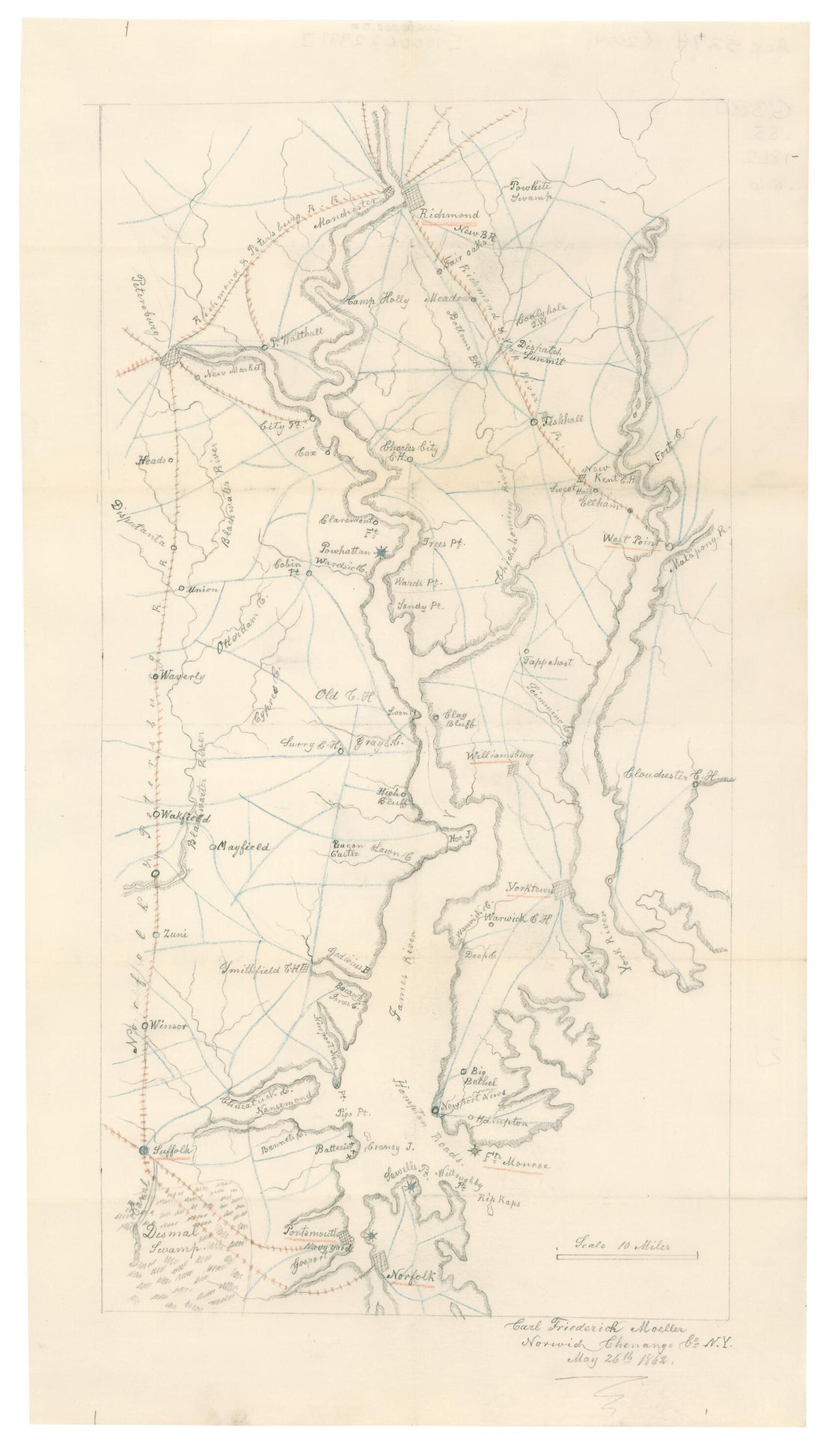 Map of Eastern Portion of Virginia : Fortress Monroe, Norfolk, Yorktown, Petersburg, Richmond &c. in 1862Map of Eastern Portion of Virginia : Fortress Monroe, Norfolk, Yorktown, Petersburg, Richmond &c. in 1862
- Regular price
-
$39.95 $99.95 - Regular price
-
$29.95 - Sale price
-
$39.95 $99.95
-
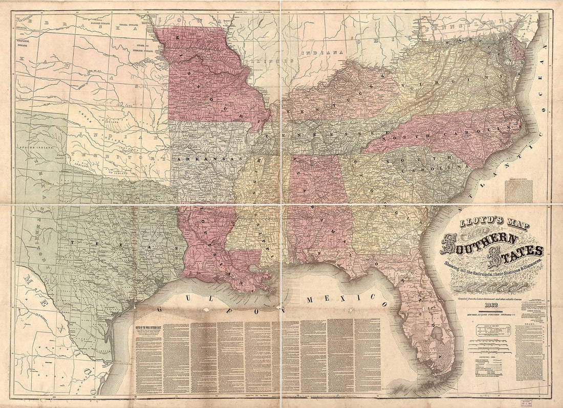 Lloyd's Map of the Southern States Showing All the Railroads, Their Stations & Distances, Also the Counties, Towns, Villages, Harbors, Rivers, and Forts, Compiled from the Latest Government and Other Reliable Sources, 1862Lloyd's Map of the Southern States Showing All the Railroads, Their Stations & Distances, Also the Counties, Towns, Villages, Harbors, Rivers, and Forts, Compiled from the Latest Government and Other Reliable Sources, 1862
- Regular price
-
$43.95 $196.95 - Regular price
-
$32.95 - Sale price
-
$43.95 $196.95


