949 products
-
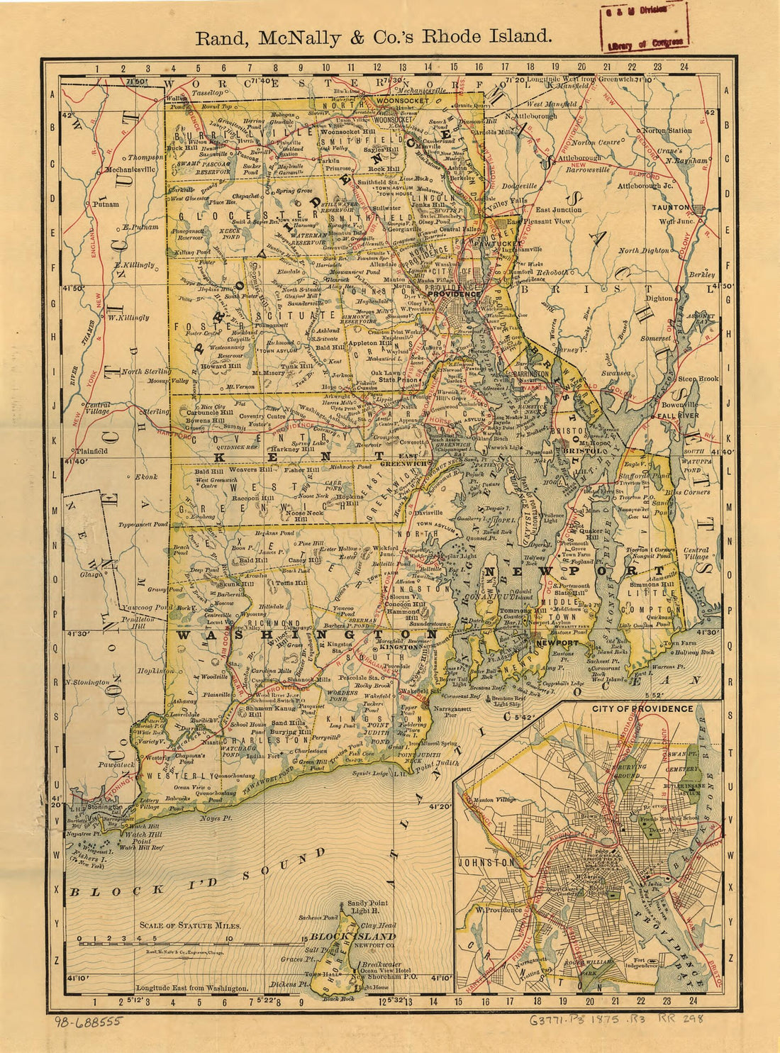 Indexed Map of Rhode Island Showing the Railroads In the State, and the Express Company Doing Business Over Each, Also Counties, Townships, Lakes, Rivers, Islands, Etc 1875Indexed Map of Rhode Island Showing the Railroads In the State, and the Express Company Doing Business Over Each, Also Counties, Townships, Lakes, Rivers, Islands, Etc 1875
- Regular price
-
$39.95 $88.95 - Regular price
-
$34.95 - Sale price
-
$39.95 $88.95
-
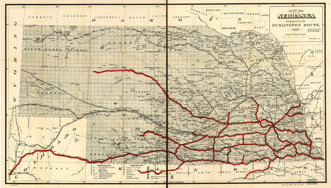 Map of Nebraska Published by the Burlington Route 1886, Compiled from the Official Records of the Government and Rail Road OfficesMap of Nebraska Published by the Burlington Route 1886, Compiled from the Official Records of the Government and Rail Road Offices
- Regular price
-
$46.95 $100.95 - Regular price
-
$41.95 - Sale price
-
$46.95 $100.95
-
 Chart of the Head of Navigation of the Potomac River Shewing the Route of the Alexandria Canal : Made In Pursuance of a Resolution of the Alex'a Canal Company Oct. 1838Chart of the Head of Navigation of the Potomac River Shewing the Route of the Alexandria Canal : Made In Pursuance of a Resolution of the Alex'a Canal Company Oct. 1838
- Regular price
-
$46.95 $99.95 - Regular price
-
$41.95 - Sale price
-
$46.95 $99.95
-
 Map of the Territory of the United States from the Mississippi River to the Pacific Ocean; Ordered by Jeff'n Davis, Secretary of War to Accompany the Reports of the Explorations for a Railroad Route 1858Map of the Territory of the United States from the Mississippi River to the Pacific Ocean; Ordered by Jeff'n Davis, Secretary of War to Accompany the Reports of the Explorations for a Railroad Route 1858
- Regular price
-
$43.95 $210.95 - Regular price
-
$38.95 - Sale price
-
$43.95 $210.95
-
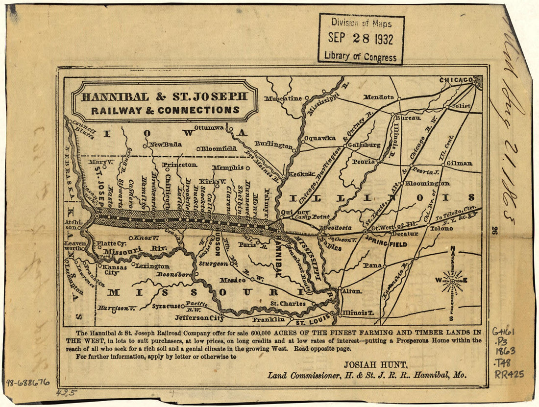 Hannibal & St. Joseph Railway & Connections 1863Hannibal & St. Joseph Railway & Connections 1863
- Regular price
-
$39.95 $88.95 - Regular price
-
$34.95 - Sale price
-
$39.95 $88.95
-
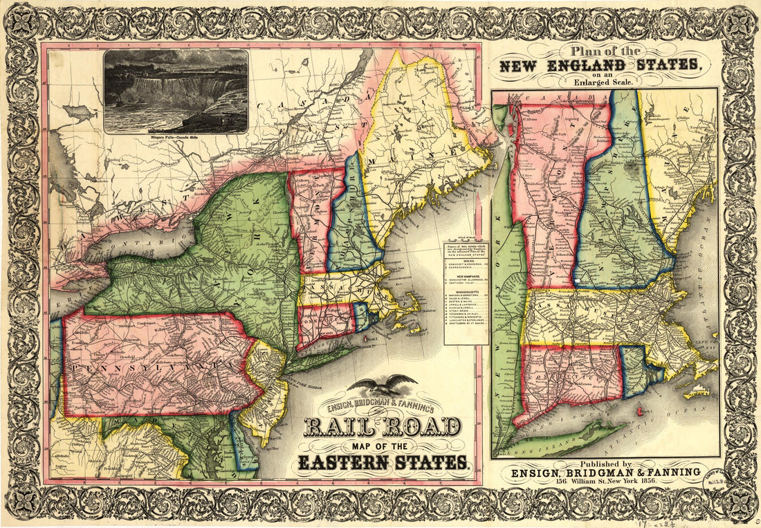 Ensign, Bridgman & Fanning's Rail Road Map of the Eastern States 1856Ensign, Bridgman & Fanning's Rail Road Map of the Eastern States 1856
- Regular price
-
$46.95 $99.95 - Regular price
-
$41.95 - Sale price
-
$46.95 $99.95
-
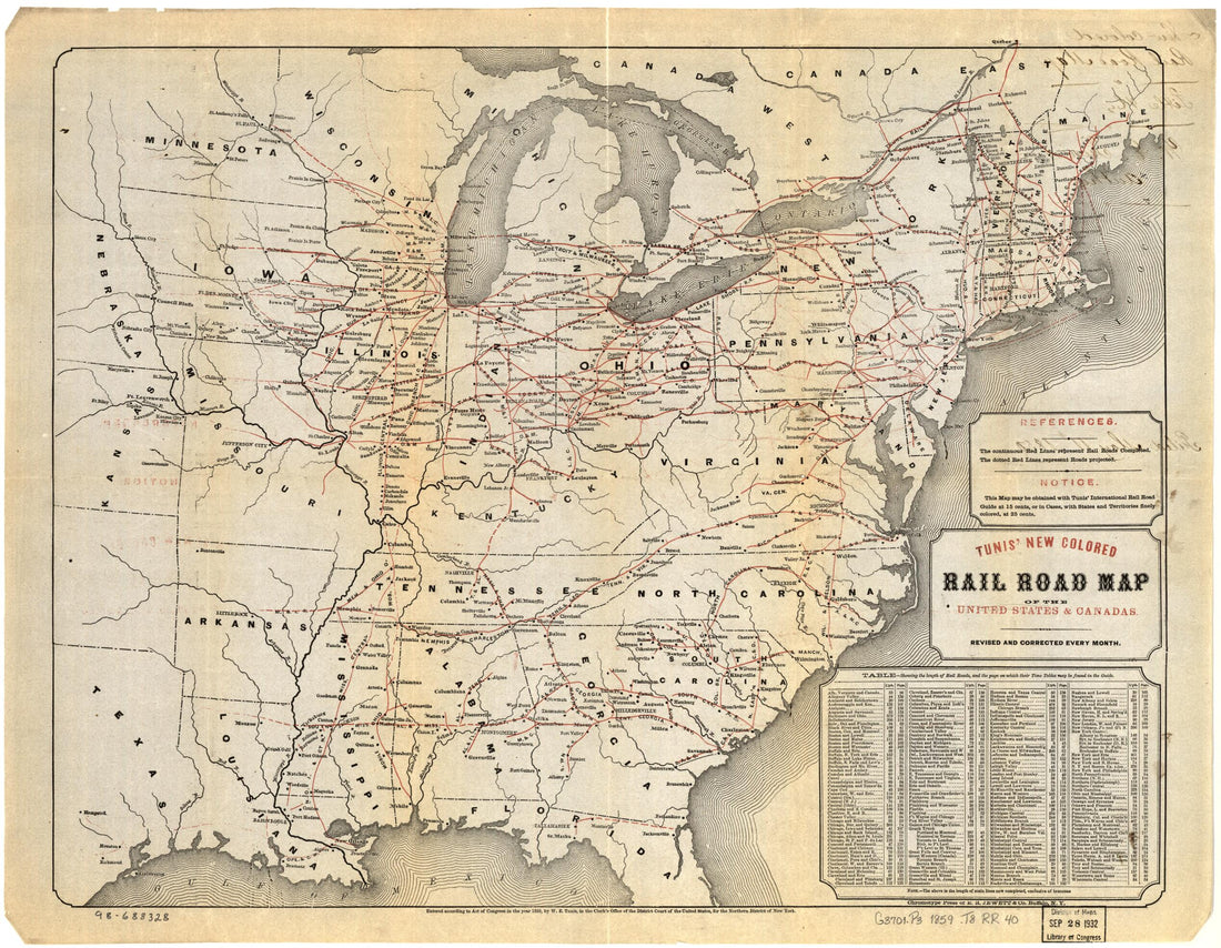 Tunis New Colored Rail Road Map of the United States & Canadas; Revised and Corrected Every Month 1859Tunis New Colored Rail Road Map of the United States & Canadas; Revised and Corrected Every Month 1859
- Regular price
-
$43.95 $83.95 - Regular price
-
$38.95 - Sale price
-
$43.95 $83.95
-
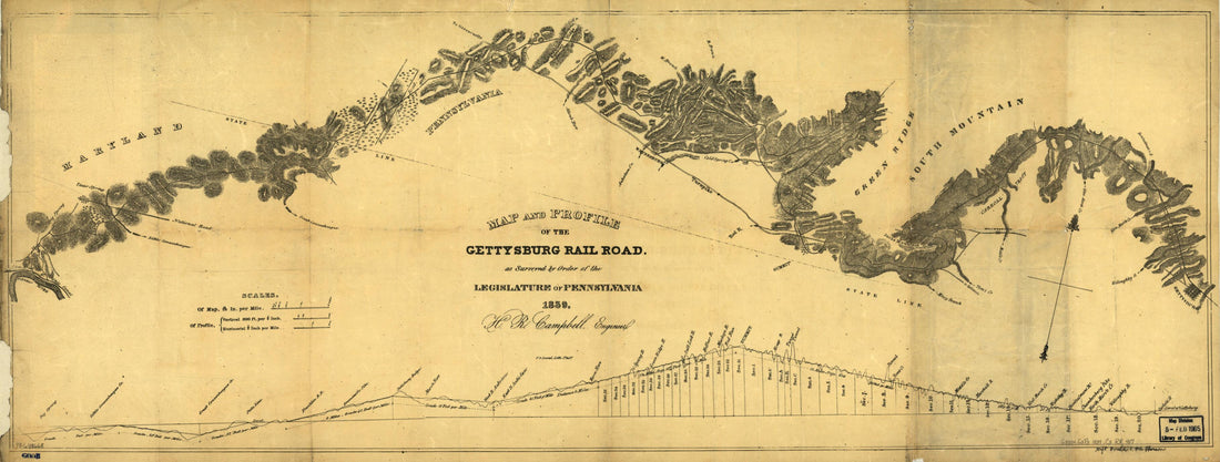 Map and Profile of the Gettysburg Rail Road As Surveyed by Order of the Legislature of Pennsylvania, 1839Map and Profile of the Gettysburg Rail Road As Surveyed by Order of the Legislature of Pennsylvania, 1839
- Regular price
-
$46.95 $99.95 - Regular price
-
$41.95 - Sale price
-
$46.95 $99.95
-
 United States, As Military Lines; Under the Direction of Bvt. Brig. Gen D. C. McCallum, Director and General Manager 1866United States, As Military Lines; Under the Direction of Bvt. Brig. Gen D. C. McCallum, Director and General Manager 1866
- Regular price
-
$46.95 $106.95 - Regular price
-
$41.95 - Sale price
-
$46.95 $106.95
-
 Map of the Pittsburgh District Showing Railroad Terminals and Location of Iron and Steel Works Having Track Connections 1906Map of the Pittsburgh District Showing Railroad Terminals and Location of Iron and Steel Works Having Track Connections 1906
- Regular price
-
$46.95 $99.95 - Regular price
-
$41.95 - Sale price
-
$46.95 $99.95
-
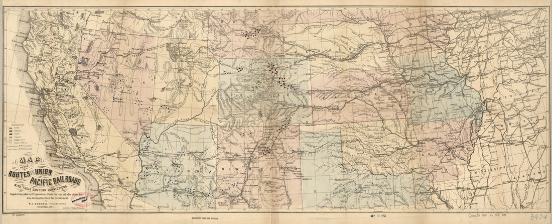 Map of the Routes of the Union Pacific Rail Roads With Their Eastern Connections, Compiled from Authorized Explorations, Public Surveys, and Other Reliable Data from the Departments of the Government, by W.J. Keeler, Civil Engineer, November, 1867Map of the Routes of the Union Pacific Rail Roads With Their Eastern Connections, Compiled from Authorized Explorations, Public Surveys, and Other Reliable Data from the Departments of the Government, by W.J. Keeler, Civil Engineer, November, 1867
- Regular price
-
$46.95 $99.95 - Regular price
-
$41.95 - Sale price
-
$46.95 $99.95
-
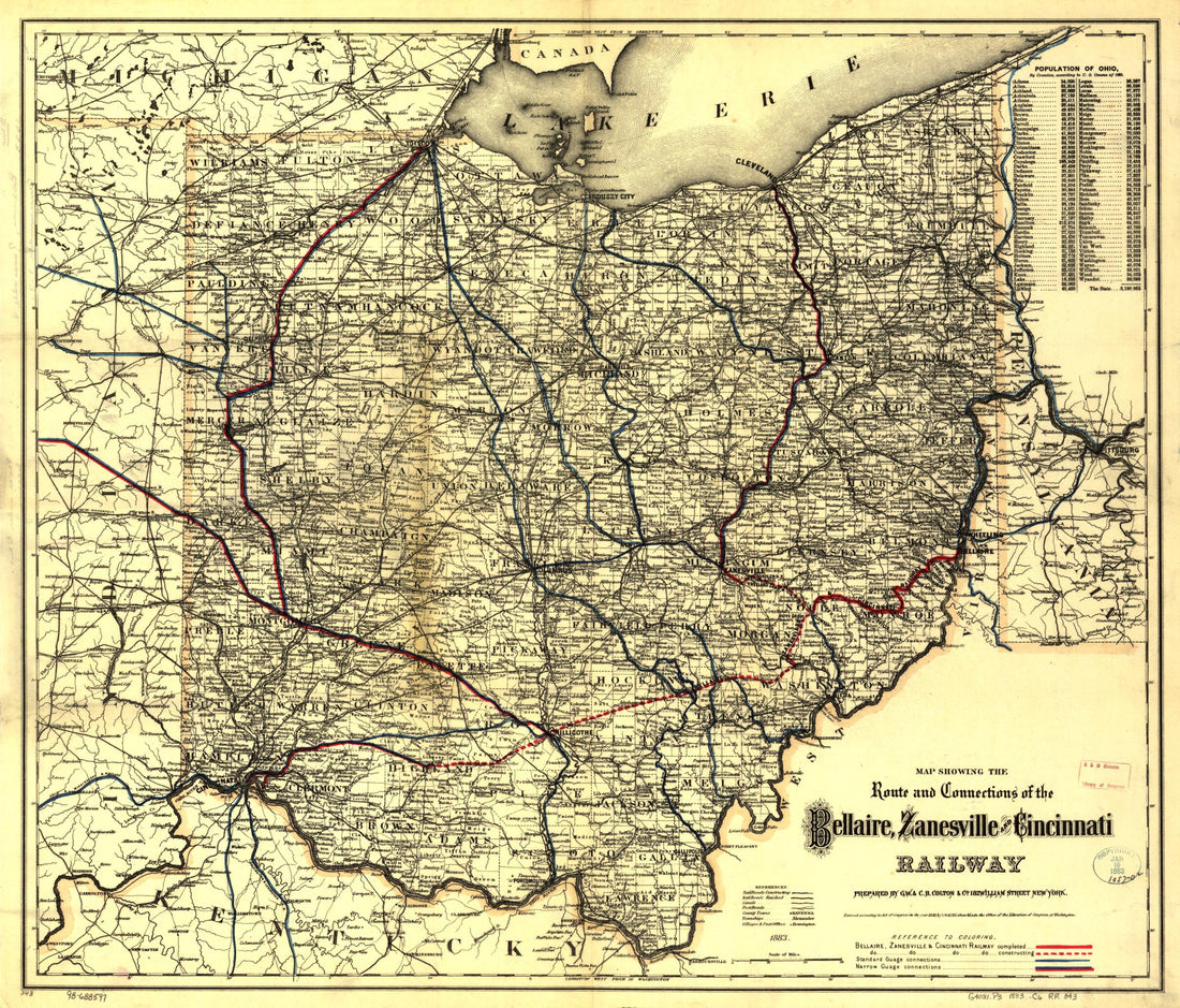 Map Showing the Route and Connections of the Bellaire, Zanesville and Cincinnati Railway 1883Map Showing the Route and Connections of the Bellaire, Zanesville and Cincinnati Railway 1883
- Regular price
-
$43.95 $83.95 - Regular price
-
$38.95 - Sale price
-
$43.95 $83.95


